May 2014
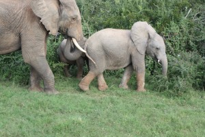
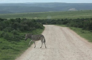
First stop out of PE is Addo Reserve where Cuthbert met his first elephants and (sorry for this)……….. a zebra crossing!
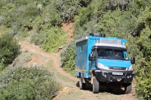
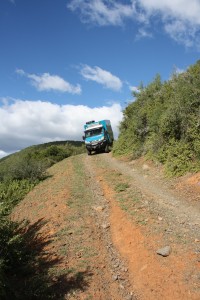
The next day in Addo Reserve, we decided to put Cuthbert (and particularly his Iveco Daily 4×4 off-road capabilities) to the test on the designated 4×4 Trail in the northern ‘Darlington Section’ of the reserve. “How hard could it be……???” we asked ourselves. Seven hours of slow and arduous driving later, the answer to this question was: “Chuffing hard!”.
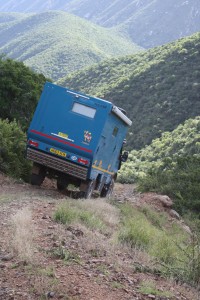
It started off simply enough, with dirt tracks suitable for any 4×2 vehicle. However it soon started to get more technical: the track winding between boulders in a dry riverbed, then a steep incline on a rough surface with tight hair-pin bends, on a narrow track. Perhaps unsurprisingly, this climb was followed by a similar descent on the other side of the ridge-line. This was then repeated over another ridge-line. And then another ridge-line. The steep climbs (over 50 degrees in places) and descents seemed never-ending, but there were some spectacular views as reward for the challenge!
During the drive we remembered the bumper-sticker motto, provided to us by our friend Greg Smith in Doha and which is displayed on the back of Cuthbert: “Keep calm and engage diff-lock”.
Overall, Cuthbert’s off-road 4×4 capability was truly impressive and he handled all the conditions exceptionally well. With the use of the low-range gears and occasional the centre diff-lock, he didn’t get stuck or struggle once.
The main ‘problem section’ of the route was one of low trees and dense camel-thorn bushes sticking into the road at the sides. Unfortunately poor Cuthbert’s shiny blue paintwork took a bit of a battering from these branches and bushes 🙁 They scratched the surface of his paintwork and he now bears a few permanent battle-scars from that day. It’s disappointing for us to see Cuthbert scratched so soon into the trip, but we are taking a pragmatic view of this: no real damage has occurred and most importantly, Cuthbert’s fabulous new yellow elephant decals did not suffer any damage 🙂 Sooner or later, minor damage of this kind this was bound to happen on this long overland trip, it’s all character-building stuff!
We eventually emerged from the trail at the Darlington Dam end of the Reserve at sunset, so we wild-camped overnight just outside the park gate.
The next day we headed back to Port Elizabeth to meet-up with our new South African friends Gavin and Lee, and our German friends Peter and Heike (now arrived in SA from Germany and having collected their ‘Cuthbert sibling truck’ from the PE docks).
June 2014
Into the Garden Route – Western Cape
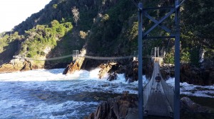
On a recommendation from our South African friends, we moved-on south-west from PE to the Tsitsikamma Reserve for a couple of days. This is a stunningly beautiful reserve, on the coast at the mouth of the Storms River in Western Cape. We had a great couple of days there, walking through the rain-forest, over the suspension bridges and did the steep climb up to the view-point on the north side of the river-mouth.
Excitingly, we also saw in the bay, our first whales of the trip! It was only a minor sighting of a couple of whales which were quite far off the coast, so we didn’t manage to get any photos (but yes, we really did see them…. honest guv!) It is still very early in the whale-watching season and we hope that as we move down the coast, we will have some more substantial sightings to report at a later date – backed-up with photo evidence!
Africa’s Bottom – Cape Agulhas
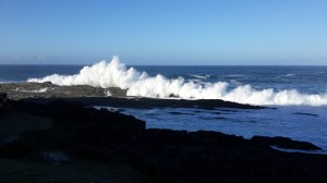
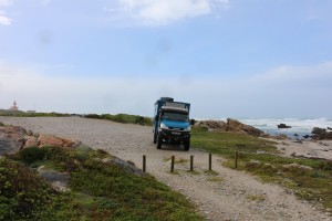
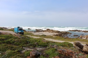
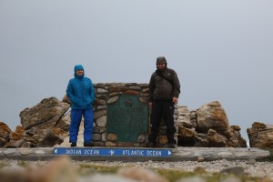
After a few interim stops along the coast, we finally reached the most southerly point of Africa at Cape Agulhas. Unfortunately when we got there, the radio weather forecasts of heavy winds and rain proved to be disappointingly accurate. As the meeting point of the Indian and Atlantic oceans, the Point is usually windy with rough seas, but the addition of driving rain to these conditions made us reluctant to get out of Cuthbert for the photo opportunity. There were some other nutter-tourists battling the elements in shorts and flip-flops; we were pleased to don our trendy gortex outfits for the occasion.
We still don’t have a firm onward route planned, but whichever way we go from here, anything other than north is likely to result in Cuthbert going for a swim and us getting a bit soggy. Northwards it is then….
The road from Cape Agulhas follows around the coast towards Cape Town along a section known as the Whale Route. It passes through various small tourist towns renowned for whale watching from a series of view-points on the coast road. As we followed along the route, the cold weather front that we encountered at Agulhas continued to batter the southern end of the Cape. Gale force winds, driving rain and hailstones continued over a few days. There was localised flooding in the rural areas that we drove through and the dirt roads became muddy and slippery. Cuthbert handled the conditions with ease, but according to radio reports, 100 kms away the road flooding was playing havoc with the Cape Town main-road commuter routes.
On a night stop in Gans Bay we had to reposition Cuthbert to face into the strong winds to minimise the rocking on the suspension and the noise from the wind whistling around the side-profile. As the rain and hailstones rattled on Cuthbert’s roof, we decided on the typically British activity of having tea and biccies, whilst watching the waves battering the beaches, rocks and habour walls, and watching the wind blow the tin roof panels off the vacated homes nearby.
Throughout the storms, life in Cuthbert was toastie-warm, dry and comfortable as we parked at various whale-watching view-points along the coast. Unfortunately, the adverse conditions meant that we were unable to see the chap that we had come to the area to see: Wally the Whale. It is arguably rather rude of Wally not to put on a show for Cuthbert when he had come so far to see him. When the sea calmed a bit, we saw a pod of dolphins and few indications that Wally and his mates were out there (water-spouts and tail-flicking out of the water), but sadly nothing massively exciting to report. June is very early in the whale season, so even when the conditions are good, Wally and friends don’t often play near the coast. And we can’t really blame them for staying under-water in these conditions; we didn’t go outside much either!
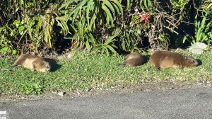
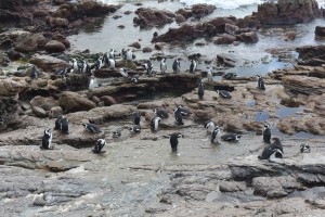
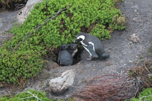
So the much awaited Whale Route turned out to be ‘not so whaley’. But during a short break in the weather at Betty’s Bay, we managed a 15 minute walk around the rocks to see Percy the Penguin, who was great compensation for not seeing Wally the Whale. It was amusing to see the penguins waddling around and living alongside a family of rock dassies.
We headed on towards Cape Town where there was thankfully a break in the weather for a day or so. We had visited Cape Town area on a previous holiday and done all the obvious tourist attractions such as Table Mountain and Robben Island. This time we wandered in the sunshine around the V&A Waterfront area and had a lovely evening visiting Jennie and Ian, who Marcus had worked with in Doha.
On leaving Cape Town through the wine-lands, over Bainskloof Pass and towards Cederberg, the rain and bad weather started again! This is winter after all, so we can’t really complain; but we now can’t wait to head north to better weather and enjoy some outdoor walking, exploring and braaing (braai is bbq in SA. See! we are all clued-up on the local lingo already!) .
If there is any benefit for us to gain from the bad weather, it is that we have time to sit in Cuthbert with tea and biccies doing admin stuff. Even a random nomadic lifestyle requires a small amount of admin. When we have mobile/internet coverage (via an SA local sim card), we catch up on emails, Facebook and updating the website (not to mention checking the weather forecasts!). When there is no phone signal we read-up and plan the future phases of our trip. Marcus also does some technical analysis stuff on Cuthbert’s engine performance. So much to do; it’s all pretty hectic really 🙂
The (allegedly) scenic Cederberg
Heading north out of the Western Cape Province, we took the route up through fruit growing region, stopping in Ceres to stock-up on the critical essentials such as wine, beer and food, then over the Middelberg Pass towards Cederberg and Clanwilliam.
Although we were now well north of the Cape’s wind and rain storms, it was still chuffing chilly. And there was still sufficient cloud over the mountains that we didn’t quite get the full beauty of the scenery as described in our travel guide books. As Brits, we should in theory be well accustomed to such adverse conditions, donning a ‘pac-a-mac’ and venturing out for long walks in the bracing winter air, displaying at all times a traditional ‘stiff upper lip’ and ‘devil may care’ attitude to the wintery conditions. But having spent so much time living in the sunshine, we are ‘Wimp Brits’. And we did not come to Africa to participate in such ridiculously British activities. The conclusion therefore, is to abandon any thought of enjoying the (allegedly) spectacular Cederberg National Park, and head further north towards the sunshine!
As we climbed over the Middelberg Pass away from Ceres, it started to rain (again!) which shortly turned to slushy snow! About half way up the pass, a sign read: “Heavy vehicles continue from here at own risk”! Hmmm. Not a very helpful warning. Just how heavy is “heavy”? Did this include the likes of Cuthbert’s 5.9 tons? And what exactly is the “risk”? We wondered maybe a narrow road to negotiate, or a weak bridge to cross……? We continued up the road with caution, waiting to see how ‘risky’ it became. The climb became steeper and the tarmac surface turned into an unsurfaced mud/gravel road, but it was plenty wide enough and Cuthbert handled it with ease. As we crested over the top of the pass, we realised the reason for the warning sign: a steep descent with ‘hair-pin’ bends all the way down. The gradient did look slightly daunting, but putting Cuthbert into low-range gear, we chugged slowly and surely around the bends and down the steep hill. Hurrah! No problem for the talented Cuthbert 🙂
Namaqualand – into Northern Cape
Leaving Clanwilliam, there was a slightly tedious 3 hour slog up the N7 with endless road-works, until we turned off into ‘the bondu’ of Namaqualand. Our quest to find sunshine and fine weather had now well and truly paid off! 27°C outside in the afternoon, and not a cloud in the sky 🙂 The countryside had changed completely from the green, fertile fruit-farming areas around Cederberg, to vast open landscapes of rough bushy-scrubland with the (very) occasional farm-house. These might optimistically be described as sheep farms, but realistically they seemed to be dwellings with the odd goat grazing on the bushes around the side of the road. There are not many people in this part of South Africa!
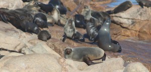
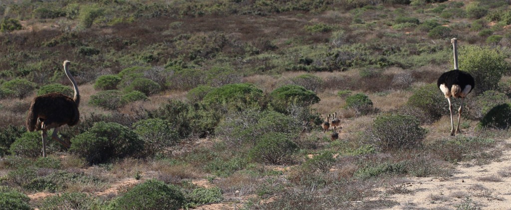
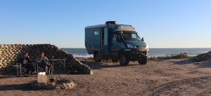
The helpful lady at the gate to the coastal section of the Namaqualand Reserve explained that we could choose any camp-spots that we wanted as we would be the only people in the whole reserve! The coastal scenery in the reserve is beautiful; a long succession of rocky coves and sandy beaches. As we drove up the track we saw lots of ostriches and red hartebeest around the bush, and a colony of seals at one of the rocky headlands. Whilst having breakfast on Day 2 in the Reserve, we watched a pod of dolphins playing in the waves just a few metres out from our camp-spot. Unfortunately, our photographic skill (and patience) has not yet extended to getting good pictures of fast moving sea-life from the shore, so you will just have to believe us on this one!
The track along the coast and through the Reserve became very deep, soft sand in places, so we were able for the first time to test Cuthbert’s ability in these conditions. We have extensive experience of soft-sand driving from our time in the Middle East with Toyota Fortuners, but we weren’t sure whether Cuthbert would fare quite so well with his 5.9 tons digging into the sand! Yet again, Cuthbert impressed us with his performance: with slightly reduced tyre pressures and occasional use of the diff lock, he rolled effortlessly over the soft sand, without any sliding or wheel-spinning. Top chap that Cuthbert you know!
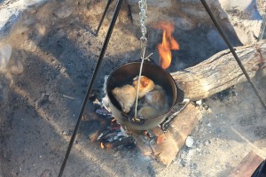
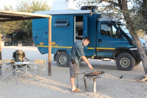
Another ‘first’ for us in the Namaqualand Reserve, was to cook a meal over an open fire in our new ‘potjie’ (yes, local lingo again! To the uninitiated, that’s a Dutch Oven or cast-iron cooking pot). Potjies are widely used in this part of the world (together with the ubiquitous South African ‘braai’), but we are told they can take a bit of time/trial and error, to master successfully. Our first attempt was simple chicken stew, which worked a treat. We threw in some chicken joints, a few herbs and veggies – easy peasy! The secret probably lies in the volume of Merlot that is consumed by the chefs during the cooking process. Next time, a smoked salmon soufflé maybe? 🙂
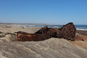
Leaving the Namaqualand Reserve by the northern gate, we found an interesting ship-wreck near Hondeklip Bai. The Aristea had been a Scottish fishing vessel, converted to a minesweeper for World War II. It was brought to South Africa towards the end of the war and foundered on the rocks on its way to Port Nolloth in 1945.
After a night parked on the beach near Hondeklip Bay, our route north towards Port Nolloth transited through the De Beers diamond mining concession area. We passed through the road blocks to comply with their security procedures, then continued up the road with the light sparkling and glinting off the shards in the verges at the side. It was tempting to stop and collect some of these ‘treasures’, but closer inspection identified that disappointingly, the light was reflecting off pieces of broken bottles thrown out of passing cars, rather than any surplus diamonds 🙁
Port Nolloth is a small (and slightly rough) but interesting diamond-mining town. It also serves as a stop-off for overland travellers buying final supplies in the small Spar supermarket – the last chance to get the essential wine, beer and fresh food before the wilderness of the Richtersfeld. We stayed there for one night on a campsite by the beach. On a morning walk along the shore in the ‘posh’ part of town, we noticed that the large sea-front villas did not have the same level of security fencing around the gardens and doors/windows that we had seen in other parts of South Africa. This remote part of the country would seem not to have quite the same crime level as suffered in towns further south.
A couple of hours further north still, up the coast from Port Nolloth is the small and rather strange diamond mining community of Alexander Bay. It is the most north-westerly point of South Africa, sitting at the mouth of the Orange River, which forms the border between South Africa and Namibia. The Alexander Bay settlement was purpose-built for the diamond miners and their families, however a lack of maintenance has created a strange ‘tumbleweed’ feel to it: very few people around the streets, but still having evidence of an active community with a church and a small school etc. We drove around the area for a while to see if we could find any redeeming features in the settlement, but we were unable to find any angle from which it would be worth getting out of Cuthbert to take a photo!
Moving swiftly on…. following the Orange River away from the coast, we headed in-land towards the Ai-Ais/Richtersfeld Transfrontier Park. We loved our week in the Richtersfeld and could write volumes for this section, which would probably not hold any immediate fascination for those with only a passing interest in our travels. We also have trillions (well, almost) of photos and extensive video footage, which we don’t have capacity to upload onto the website. We will therefore try to keep this account brief and include sufficient pictures to give you a taste of this amazing place.
The Reserve straddles the border between South Africa and Namibia, with Ai-Ais being the Namibian half and Richtersfeld being on the South African side. The dividing line is the Orange River which forms the national border. For this visit, we remained in the South African side of the river, but we plan to include the Ai-Ais side of the Reserve when we venture into Namibia at a later date.
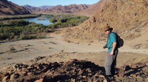
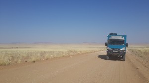
The Richtersfeld is a remote Reserve and ‘proper 4×4 adventure territory’. The tracks range from very rough and rocky through the mountain areas, to very soft with deep silt-sand along the river sections, to the occasional flat gravel across the plains. They are mostly hard-going and Cuthbert’s speed ranged between 3km/h to 35 km/h. In places the terrain is stark, rocky and almost ‘moon-like’ (not unlike the scenery of a random ‘other planet’ from the 1960s early Star-Trek TV episodes). In the valleys between the mountains, there are flat desert plains; but by the river there are sandy shores and lush green vegetation.
There is no mobile phone network across the Reserve, and the main camping areas are around 3 hrs drive from the Reserve Gate Office, so we needed our satellite phone for emergency connectivity with the outside world (thankfully, not actually used).
There are no facilities in the Reserve. Campers must be totally self-sufficient, bringing all their own drinking water (shower water can be taken from the river), supplies, vehicle spares and recovery equipment for if you get stuck! These are exactly the type of conditions that Cuthbert was made for! We had seen videos of the area made by the South African 4×4 enthusiast Andrew St. Pierre-White, and we had been looking forward to testing Cuthbert in this remote wilderness.
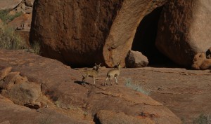
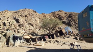
Although there is plenty of small wildlife in the Reserve (e.g. monkeys, baboons and small deer) unlike most other reserves in Africa, there are no predator animals and it is therefore safe to go for walks. The camp spots in the reserve are very broadly designated zones, with no specific plots allocated. Campers are given a rough (and totally rubbish) hand-drawn map, plus GPS coordinates to find the general vicinity where camping is permitted. You can then find your own preferred space to set up camp. During our week there, we only saw only five other vehicles in the whole Reserve, so we had the pick of the best camp-spots.
Our first night on arrival was spent near the main entrance at Pootjiespram. This camp area, surrounded by mountains of mining activity, is a disappointing and misleading introduction to the Reserve. Moving on across the Pass towards the De Hoop area, the natural landscape and road conditions for which the Reserve has earned its reputation, started to unfold.
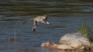
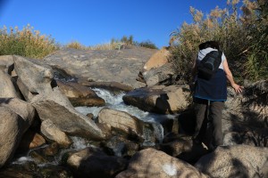
We spent 4 days along the river watching the wildlife: the trout jumping in the river, the baboons in the trees, the kingfishers hovering high over the river then swoop-diving down to the water. The monkeys were mostly in the trees and bushes, but the most entertaining time was watching them jumping and swimming from rock to rock, as they crossed sections of the river.
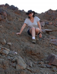
Away from the river, we spent a few days in the Kokerboomkloof area. This area is quite different to the riverside, but equally beautiful. As they say…. ‘A picture paints a thousand words’, so we’ll stop going on about this and let you judge for yourselves from the selection of piccies that we have put into this little slide show.
We have also put together a short video with clips taken from inside and outside of Cuthbert as we passed through the park. Steven Spielberg will probably not be concerned about any competition from the quality of this production, but it was fun for us to make (and we have to do something creative with our down-time whilst we are travelling) 🙂
Time for a bit of ‘Domestic Admin’
During our time by the river, we took some time to catch-up on the every-day routine stuff. Cuthbert provides us with the power and space for most of the ‘luxuries’ of modern life, such as lighting, hot-showers, central heating, cooling fans, lap-tops, sat-navs, fridge/freezer, a food blender and for Julie, the ever-essential hair-drier. Unfortunately however, Cuthbert’s impressive facilities do not quite extend to an automatic washing machine and tumble drier. A small downside to our lifestyle is that we will now occasionally need to wash our clothes by hand 🙁
So far on our travels, we have not had to undertake this chore as we have either managed to find occasional camp-sites with a washing machine, or kind friends have offered the use of their washing machines (the last one being the lovely Jenny in Cape Town). Hand-washing clothes is therefore not a domestic chore with which we are familiar, although Julie did get her ‘Good Housekeeper’ badge in the Brownies, so we have some expertise to draw on 😉
Leaving the Richtersfeld Reserve, we headed slightly south past Kuboes, then east through some very remote terrain, past Eksteenfontein and on to the Helskloof Pass.
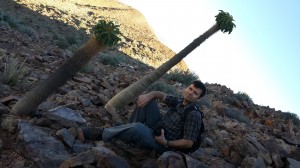
Up a steep scramble-climb, on a hillside at the side of the road (as marked on the brilliant T4A sat-nav mapping) are some extremely rare ‘halfmens’ trees. The ancient indigenous people apparently believed these to be men that God had turned into plants, to save them from an uncertain fate. The plants have spikey trunks and lettuce-like flower-tops, which apparently resemble the caps on the heads of the men (although we think it would take a vivid imagination and probably the ingestion of some whacky substance before this alleged resemblance sprang to mind). Anyway…. we were delighted to find these plants on the hillside as they are almost extinct. They grow only a few millimetres a year, so the ones that you see in the picture here have been around for quite a while.
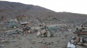
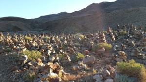
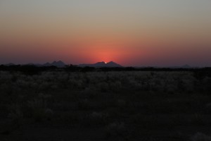
Shortly after the climb to the trees, the Pass descends and opens out into a wide dry-river bed in the bottom of a large canyon valley. At each side of the sand-track in the valley floor, are literally hundreds of small piles of stones, each assembled by a traveller who has passed through the Helskloof on their way east. This sheer volume of these small stone piles is an amazing site at sunset, with the stones mini-stacks and the canyon sides glowing orange as the sun went down. We decided to park up and camp in the valley for the night, and built our own ‘Cuthbert pile’ to add to the ever increasing field of small stone-stacks.
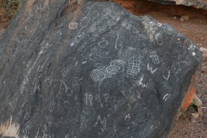
Next morning we drove further down the valley to find some ancient petroglyphs, allegedly drawn by a Nama tribe thousands of years ago. These sketchy patterns and a few stick-men drawings would probably not sit alongside the Elgin Marbles or the Rosetta Stone as the world’s most significant examples of ancient artefacts, but Marcus was probably missing the point with: “They weren’t exactly artists were they?”
Finally leaving the Helskloof valley and joining the Orange River (again), we crossed the main N7 (Cape Town to Windhoek) highway and zig-zagged east, cross-country towards the small town of Pella. Other than the gathering of mega-trucks at the lorry park on the N7, we saw only 3 or 4 other vehicles over two long days of driving.
The scenery all the way from our last camp at Richtersfeld, to joining the N14 near Pella, was nothing short of spectacular. The mountains gave way, via the Helsfkloof Pass and canyon, to vast open plains with long straight roads from horizon to horizon. The road surfaces were rough-going at times, but the two long days of driving were nevertheless an interesting and beautiful part of our journey.
As we stopped for the night in a quiet spot between Pofadder and Augrabies, we received a voicemail on the satellite-phone that Julie’s brother Ben and sister-in-law Tracey, had their baby son Joel that morning. Well, we say Ben and Tracey, but it was just Tracey who probably did most of the hard work 🙂 Great news and many congratulations to them all.
Kalahari-bound, with Augrabies on the waySince leaving Cape Town, we had miserably failed to compile any semblance of a plan to our route for the next few weeks (or even days). However one place that we were sure we wanted to include was the Kgalagadi Transfrontier Reserve in the Kalahari Desert. We had previously tried to reserve camp-spots there, but it was full. We now had a bit of luck securing a few nights availability at short notice due to a cancellation. Tip-top news – Kalahari here we come!
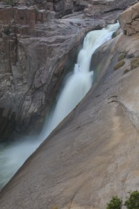
With ‘Target Destination Kalahari’ in a few days’ time, we continued to work our way east-wards across Northern Cape Province and had time to stop off at the Augrabies Falls on our way. We stopped there for a couple of days and walked the splendid ‘Dassie Trail’ around the southern end of the park.
At Augrabies there was also a rare opportunity for us to eat in one of those places where a waiter brings the food and wine to the table for you, and you don’t have to do the washing-up afterwards! A restaurant was a nice treat for us as we don’t often camp in places with such ‘1st World Facilities’.
After Augrabies, rather than head straight back down to main road, we set out on the minor tracks to the north, over the Blouputs bridge and through the village of Riemvasmaak. This village has an interesting history as the first land to be handed back to its original occupants by the new Mandela government in 1994. The area also featured in a TV programme in UK last year, with Julia Bradbury highlighting South Africa’s best hikes. We didn’t have time to walk the long trek that Julia did in her programme, and the supposedly ‘hot springs’ in the bottom of the canyon might better be described as ‘tepid pools’. Nevertheless, it is a beautiful area to visit and we were pleased to have made the half-day detour on our way through the area.
Next we stopped off in the main regional town of Upington to stock up again on wine, beer and food. It was also a rare opportunity for some retail-therapy in the brand new Mall on the outskirts of town. We spent a couple of days in town, not only food shopping, but investing in some clothes, a bargain new 50mm camera lens and some comfy ‘Oz-tent’ chairs to lounge outside in the (now every-day occurring) sunshine.
One of the minor downsides to travelling in remote areas is the lack of fresh food in the small local shops. We have stocked up on various long-life items and we have a freezer to store meat and fish. However one food that we miss is fresh yogurt. Our innovative solution to this problem, is to try a culinary experiment: making our own yoghurt! Don’t laugh…. read on!
Anyone who knows us will confirm that we are not the most domesticated people and neither of us has ever been known to bake a cake. However we did a bit of inter-web research and were assured that making yoghurt without a machine is much simpler and quicker than you might expect (Google it if you are interested, but assuming that you are in civilisation, you probably have better things to occupy your time). It takes about 10 mins to prepare, then just leave overnight in a flask. Abracadabra, hey-presto….. fresh, creamy yogurt in the morning!
It worked! So if you either: (a) have little better to do with your time; or (b) are travelling in rural Africa and can’t find fresh yoghurt in the shops; you may like to give it a try (see Yoghurt).
Multi-tasking in the Kalahari… game viewing whilst defrosting the fridge
Finally, heading north out of Upington, Cuthbert took us on the 4 hour drive to Twee Rivier at the entrance to the Kgalagadi Reserve.
The Kgalagadi is another remote reserve, covering part of the wider Kalahari Desert. On the east side, the Kgalagadi straddles the South Africa/Botswana border; the western boundary of the Reserve forms the South African border with Namibia. The Kgalagadi acts as a kind of huge ‘no-mans land’ between the three countries. On entering the Reserve, you have to commit to your exit point. If you plan to exit the Reserve into a country different to the one from which you entered, then the border-crossing formalities for leaving South Africa must be completed on entering the Reserve rather than at the exit gate.
We decided that after our visit to the Kgalagadi, we would exit into Namibia at the Mata-Mata gate and therefore cleared the border formalities for leaving South Africa as we entered the Reserve. The officer at the gate inspected Cuthbert’s ‘Carnet de Passage’ (the international document for temporarily importing vehicles) and then asked us to show him how to complete it! This is our first African border crossing with Cuthbert, we hope that all the future crossings will be this easy!
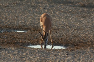
During our time in the Kgalagadi Reserve, we noticed that our fridge/freezer was being less than efficient. The fridge temperature was edging towards 7C and the freezer looked a bit thick with ice. Having stocked up with fresh food in Upington just a couple of days before, we were concerned about ruining our precious bbq/braai supplies which, if lost, could not be replaced for several days until the next town in Namibia. Our diagnosis was that a de-frost might sort the problem. Rather than spend time in the camp doing this, we pulled over to the side of the track, near a water-hole in the middle of the Kgalagadi. Placing all the fridge/freezer contents into a large bag and wrapping in bedding to keep it cool, we de-frosted the freezer whilst watching springbok, wildebeest, oryx and (apparently rarely seen) brown hyena drinking at the water-hole. By the time the animals had wandered off, the de-frosting was complete and the fridge problem sorted! Hurrah for Cuthbert’s multi-tasking abilities!
Game viewing in most African reserves is a matter of luck and patience, particularly when self-driving (as opposed to the guided trips that we saw in the Serengeti last year, where radio-linked safari guides create crowds of vehicles around sightings of the ‘Big 5’). Some days you can see a wide range of animals carrying out entertaining activities, and waterholes crowded with thirsty beasts jostling for best place ‘at the bar’. Other days you can drive or sit for hours, seeing only the ubiquitous springbok and oryx. Luckily for us, we are currently ‘time-rich’ and not so bothered by any down-time waiting for the animals. As we park and sit by water-holes waiting for the chaps to get thirsty and seek out a drink, we can climb into the back of Cuthbert and relax with a cup of tea, enjoy some lunch, maybe defrost the fridge, or even type-up the latest update to our Africa-blog that can be added to the web-site when we next have internet access!
Amongst the best of our many animal sightings over five days in the Kgalagadi Reserve included:
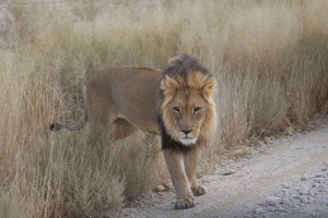
- a group of three lions very close to Cuthbert at the side of the road;
- a family of cheetahs playing on a ridge-line just off the side of our road;
- a lioness playing with her cub just a few metres in front of our viewing hide, followed by the male lion moving in for a drink;
- a stare-off between a huge eagle-owl and a jackal (watched at night from a hide under sodium lights)
- a lone brown hyena at a waterhole
- a stand-off between a spotted hyena guarding his family and an inquisitive herd of wildebeests; and
- a lone male cheetah drinking at a water-hole, then trying but failing to climb a nearby tree and walking away in shame “I never really wanted to go up there anyway” 🙂
We were also lucky to witness an event common amongst many young males spending time together at a popular drinking hole: a fight scene!
From the comfort of our lunch table in the back of Cuthbert, we had the window open to watch a herd of oryx at a waterhole. It all started, as it usually does, by one aggressive chap taunting and prodding another. They began to jostle, heads down, bashing and locking antlers with each other, kicking up a cloud of dust around them. The reason for the ‘bar-room brawl’ was not exactly clear, but it was exciting! We were so close that we could clearly hear the clack-clack of their antlers against each other, and as they continued to jostle we could almost hear the cries of a spectating female: “… leave him Wayne, he’s not worth it” 🙂
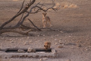
This was one of the highlight moments watching a lioness play with her cub (see the video clip added in below)
The Kgalagadi and the wider Kalahari Desert is a stunning area to view wild-life. There are no elephants, rhinos or hippos, but the opportunities to see the predator cats, as well as a wide range of other game are excellent. Nossob Camp in the central area of the Reserve, has a small hide overlooking a waterhole, that campers can walk to at any time to sit and view passing wildlife. After dark, the waterhole is floodlit with sodium lights to see the antics of the nocturnal animals ‘out on the town’. Spending an hour at sunset in a hide by a waterhole in the Kalahari makes fascinating live entertainment, more interesting than Bill Oddie’s ‘Springwatch’ and more exciting that an episode of Eastenders!
We have put together a short selection of some of the amazing wildlife that we saw, including some quite entertaining video clips of a lioness playing with her cub, and part of the oryx ‘aggro’ mentioned above.
July 2014
Those who paid attention above may recall that on entering the Kgalagadi we committed to leaving the Reserve into Namibia and we cleared the South African customs and immigration process at that time. After a great five days of game viewing, we finally left the ‘no-mans land’ at the Mata Mata gate and proceeded to the Namibian immigration office.
We have had a lovely six weeks seeing the west side of South Africa and a great start to our Africa tour. However it is mid-winter down here and the weather in the southern end of the Cape is less than accommodating for any kind of out-door activity (see above about our time in Gans Bay!). Seeking warmth, we decided to head north and the weather in the Northern Cape has been shown this to be a good plan for the time being. When the weather has improved ‘down south’ we will come back to see the east and southern sides of South Africa and Lesotho. For now, we are heading into Namibia to continue the beautiful weather and stunning scenery.
Here is a quick overview map of our route in South Africa so far (note: red line = our route on this trip in Cuthbert; blue line = our previous trips in other vehicles):
Now tune in to the appropriately named Namibia page for Cuthbert’s continuing story…. or skip forward to February 2015 when we arrive back after our loop around Africa – see Return to South Africa and April 2015 when we start South Africa: The Final Leg

