August 2014
The Great Scratch-card Buy-out
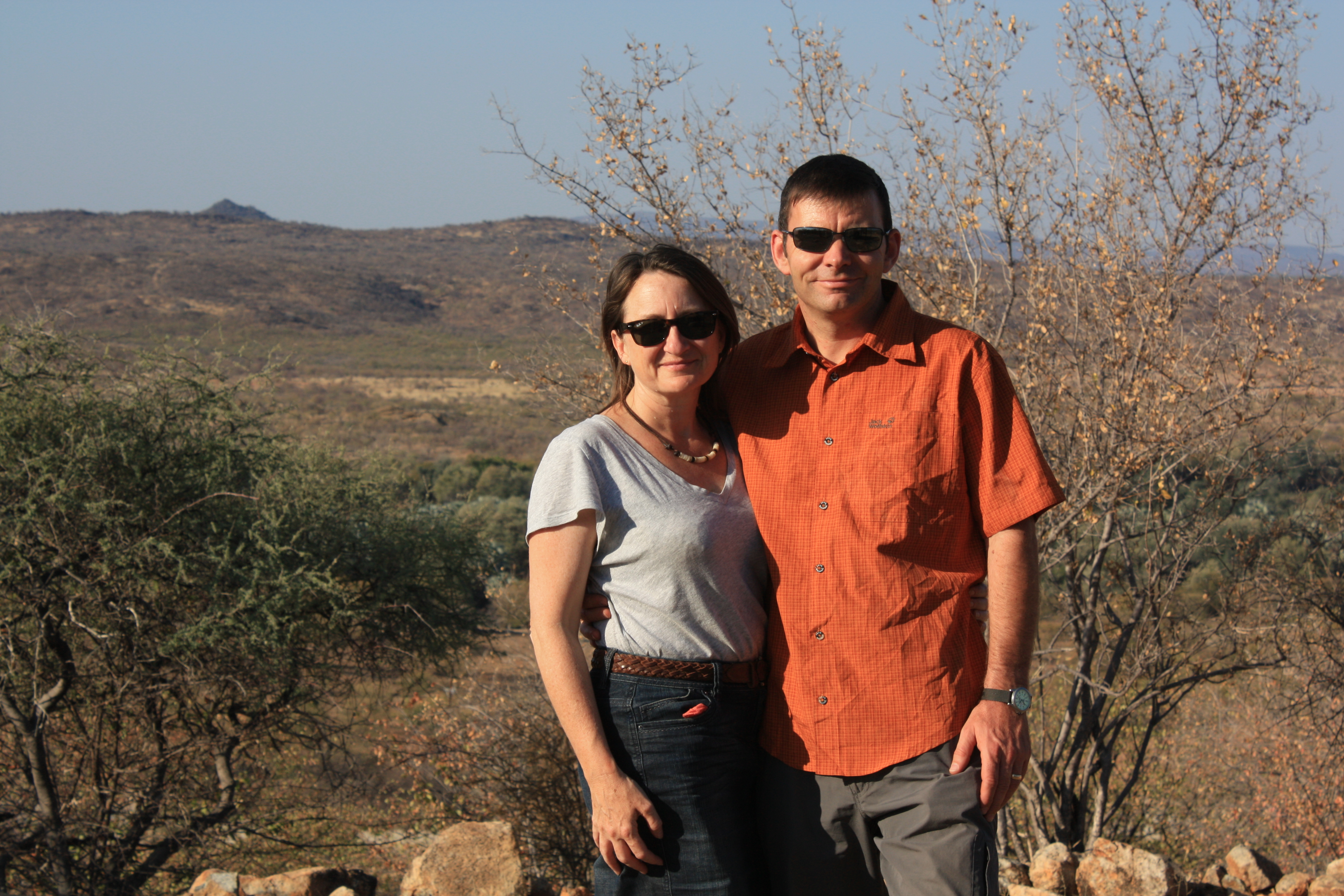
Formalities at the Mohembo border went extremely smoothly. A pleasant chap relieved us of a few Pula for Cuthbert’s ‘national road fund insurance’ and welcomed us to Botswana. We put our clocks forward an hour and headed down the road a few kilometres to the small town of Shakawe. Here we go with the Botswana Overlanding Blog!
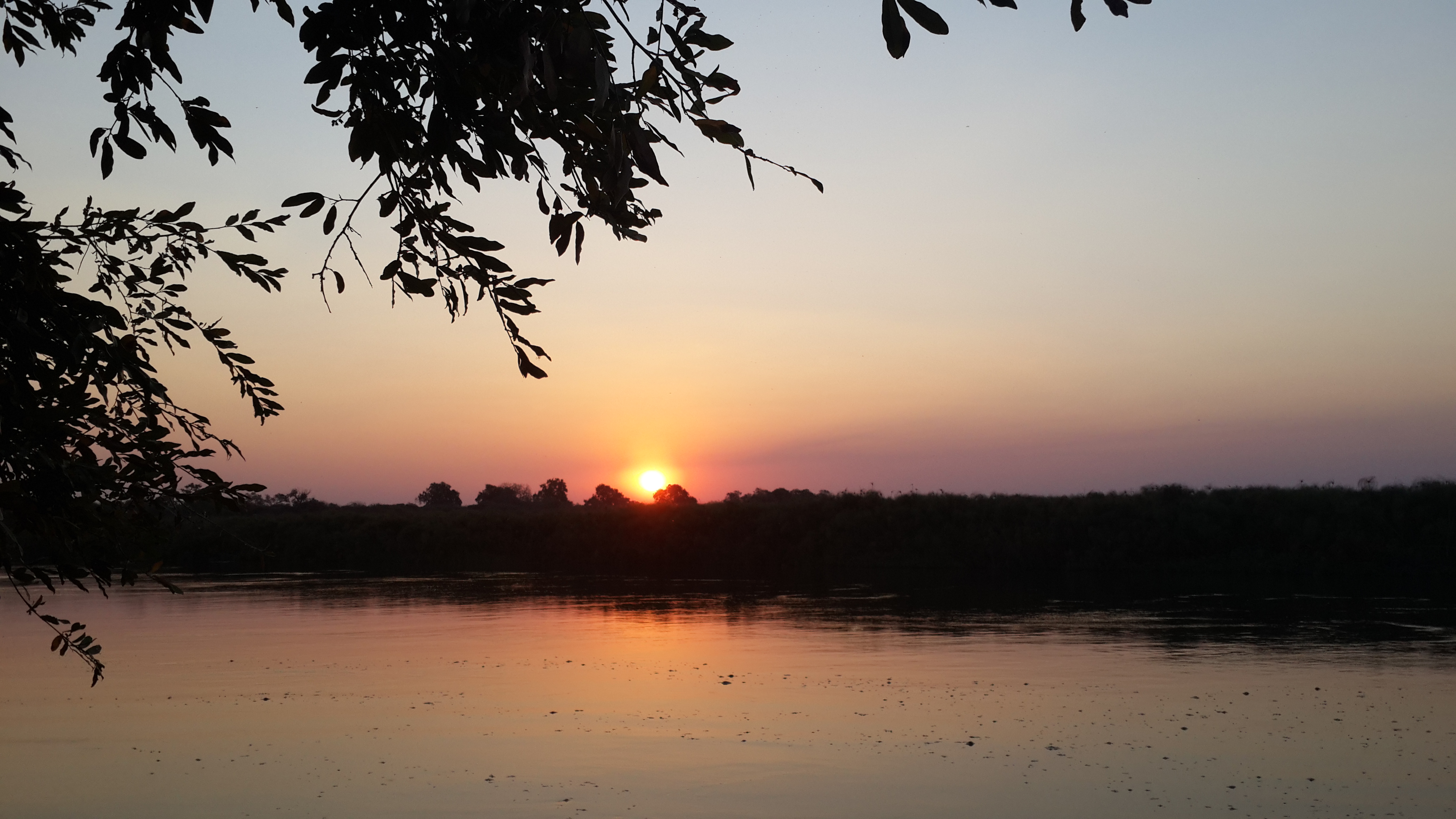
Into Botswana… about to buy out the phone-card stocks
One of our highest priorities on entering a new country is to buy a data SIM-card for our phone. This obviously allows us to stay in touch with the ‘outside world’ with emails/Facebook, to do a bit of web-research for the onward journey, and to provide you with the latest instalment of Cuthbert’s tales!!
In Botswana the deal is to buy a phone SIM, then load it up with air-time credit from scratch-cards, then convert the air-time to data-credit. Network 2G coverage is now very wide in Botswana, however use of data on mobile phones does not yet seem to have caught on; everyone seems to have a phone but only uses it for local SMS texts and calls. The result, which we hadn’t initially realised at the time, is that in a small town like Shakawe, there are only a few purveyors of air-time scratch cards, each with only a small, low value stock.
At the first store we found, we bought the last of their stock of scratch-cards. We did the same at the second store. Looking for the third store to get the final scratch-cards that we needed to make up 1GB of data capacity, we realised that there were no more stores in town selling the air-time scratch-cards. We had unwittingly bought-up the whole town’s supply of mobile-phone credit!! Ooops. We are not sure how often a small town like this is re-supplied with stocks, but to the people of Shakawe, we offer our apologies for any inconvenience we may have caused by hogging all the available air-time in your town!
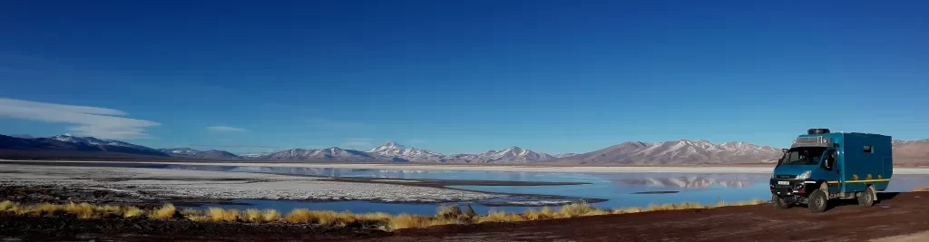
The Pan-handle
Gucci sunset over the Okavango ‘pan-handle’
The Okavango River flows from Angola, through Namibia and some way into Botswana before finally dispersing and spreading outwards into a large round(ish) pan-shaped area of hundreds of sub-rivers, lagoons, marshes and wet-lands, known as the Okavango Delta. The straight route of the Okavango River before it disperses into the pan-shaped Delta, is commonly known as ‘the pan-handle’.
We spent several days driving down the pan-handle, stopping off at various camps on the edge of some of the smaller lagoons (for anyone researching a trip, Drotsky’s and Guma Lagoon were both great, although Guma would certainly be a challenge to get to in the wet season!). There is good wild-life in the ‘pan-handle’ area and it is particularly known as a bird-spotter’s paradise. We are unfortunately (or maybe fortunately!) not bird spotters and could not identify most of what we saw, but it was still fun to see the wide range of random and colourful feathered chaps, living alongside the hippos and crocs.
A new Wallace!
Moving further into Botswana, we headed over to the centre of the Okavango tourism industry: Maun. This is the largest town in the area and a good place to replenish the food supplies. It is also a town with a GPS shop for a replacement Wallace at last – Hurrah! So we have managed to replace the stolen hardware and loaded up the T4A mapping, but the Garmin mapping was only licenced to the ‘original’ Wallace; we have not yet received a reply from Garmin about having our mapping licence transferred to the new Wallace. We are not holding out much hope for this, but it was worth an email to them to explain about the theft and to see if anything can be done.
Although we are referring to the new device as ‘Wallace’ again, we have actually not yet managed to download the ‘Wallace & Grommit’ voice-file for the new device. For now, we are accompanied by the Garmin-standard voice of ‘English – James’. James seems a pleasant enough chap and he keeps us on-track, but he is lacking the entertainment value of Wallace and his little gems: “Was that you Grommit? Or has someone else been eating boiled eggs?” 🙂 We will have to do something about this.
The Botetti flows
After Maun, many tourists in Botswana would head north towards the Moremi Reserve and the main section of the Okavango Delta, where there is the greatest concentration of game. However we have spent some time in that area on a previous trip and we are keen to see some different parts of Botswana.
We decide to head south to the Central Kalahari Game Reserve, but the route took us initially east along the Botetti River where we had been before on our way to Nxai Pan, Makgadikgadi in 2008. This time, we stopped off at Drifters Camp on the bank of the Botetti and were surprised to see the high level of water in the river. In 2008 the Botetti had been completely dry; we had driven along the dry riverbed witnessing the sad sight of a few hippos cramped into a very small water hole, plus several dead zebras and giraffes which appeared to have died of thirst. This time, it was lovely to see the river in full flow and plenty of water for the wildlife.
The Vet Fence
One of the inconvenience factors of travelling around Botswana by road is the net-work of vet fences/road-blocks. These have been in place for many years, aiming to prevent the spread of ‘foot and mouth’ and other animal diseases. The inconvenience factor is two-fold: first, the police road-blocks where you have to get out of the vehicle, taking all of your spare footwear with you, and wipe the soles of all your shoes in a tray of disinfectant. Vehicle tyres are also disinfected.
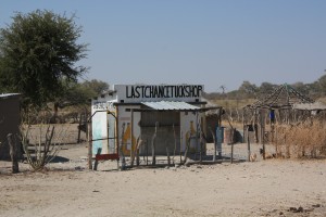
Last chance to stock-up – TUCK shop 🙂
The second and more significant inconvenience, is that you are not allowed to take raw meat through the check-points. This means that having passed through the town of Maun, with its (rarely found) well-stocked supermarkets full of juicy steaks, burgers, bacon and ribs, we could not take any such produce more than around 50km east of the town. The last time we drove along this road in 2008, we came un-stuck at a road-block where all our steaks were confiscated! This time, on the same road passing through the same road-block, we complied with the rules and took no raw meat with us. Annoyingly this time, the policeman did not look inside the vehicle; he didn’t even ask whether we had any meat! Damn!
The Kalahari (again)
Our more conscientious followers may recall that we spent some time in the Kalahari a few weeks ago, in the trans-frontier reserve between South Africa and Namibia. Well this is a different part of the vast Kalahari Desert, which spreads across much of central-southern Africa. We are now much further north-east. According to our reading, this should be a quite different wildlife and scenery experience. Okey-dokey, let’s give it a try!
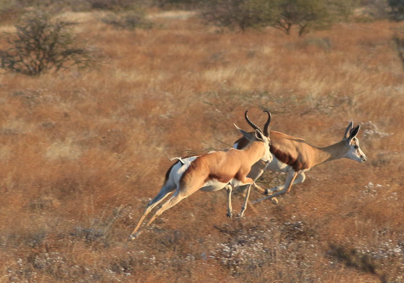
Bit of Springbok action in the CKGR
The Botswana Central Kalahari Game Reserve (known as the CKGR) is the 2nd largest reserve in Africa, after Selous in Tanzania. It is apparently larger than Denmark (but with less bacon)! As with most of the Kalahari, it is a very remote, inhospitable area and guide-books are full of warnings about the dangers of venturing into the desert unprepared (i.e. without adequate water, supplies and recovery equipment for your vehicle). At this winter time, the tracks are drier than in the summer rainy season. The downside of course, is that the waterholes are dry and there is therefore less game to be seen.
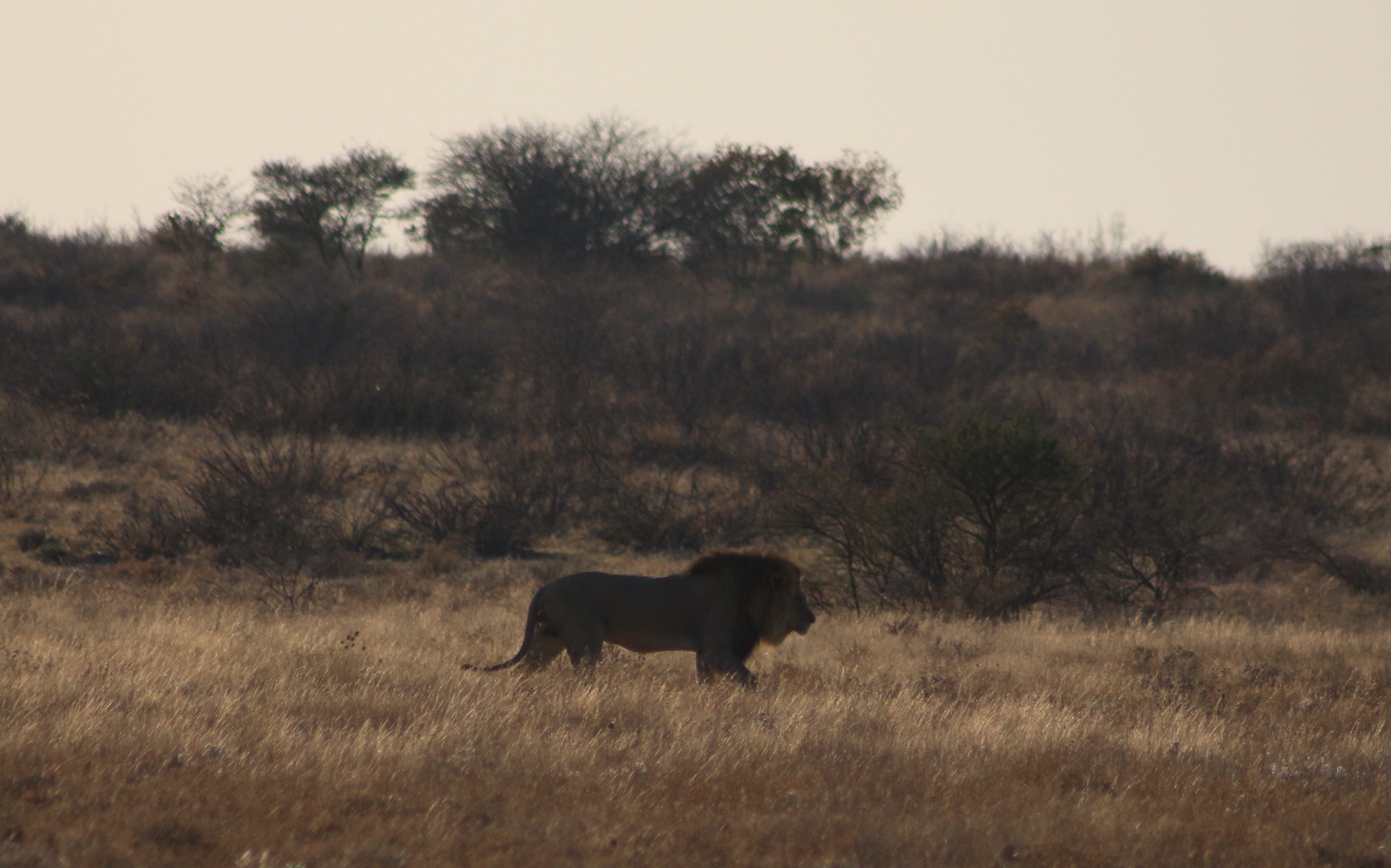
This isn’t an ordinary lion…. it’s a black maned Kalahari lion (apparently)!!
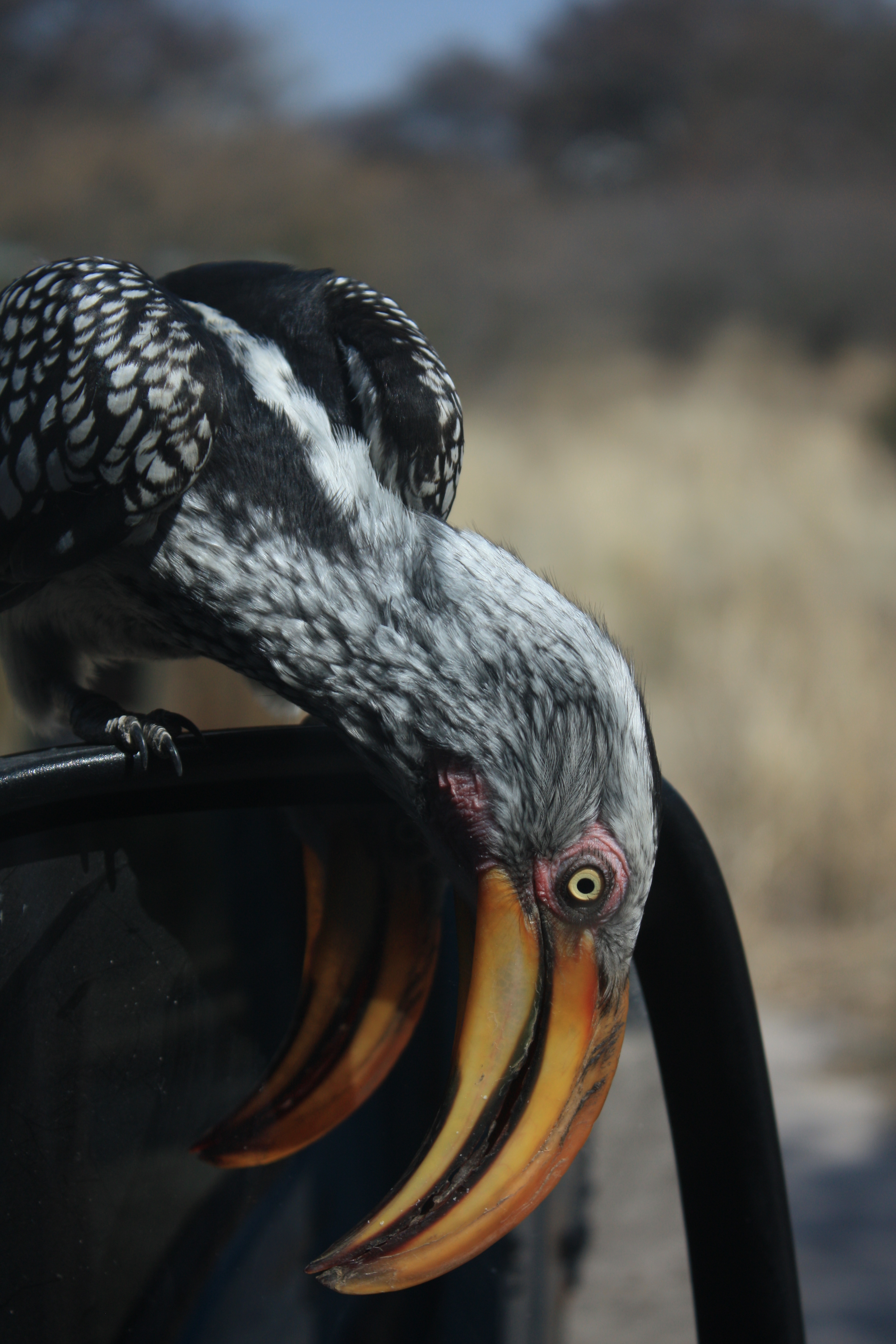
Cuthbert not impressed with a curious Hornbill on his wing-mirror
This journey into the CKGR is not one that we would recommend to anyone with limited time, expecting a ‘safari experience’. From Maun it took us around 4 hours on the main road to Rakops, then over 2 hours on rough tracks into the park, to get to the nearest camp at Deception Valley.
The roads then further into the park are very slow going. The other reserves to the north of Maun (e.g. Moremi, Savuti, Chobe) are more accessible than the CKGR and the rewards in terms of wildlife sightings are vastly superior. Nevertheless, with our slow-pace of travel, we had a pleasant few days in the park and saw (in addition to the ubiquitous oryx, wildebeest, springbok, jackals and ostriches – to which we must admit, we are now becoming somewhat accustomed around Africa and a little blasé 🙂 ) one wonderful huge Kalahari lion ‘on patrol’ near Deception Pan. Apparently, Mr Lion doesn’t parade for ‘any old traveller’ in the CKGR; sightings are quite rare! Cuthbert’s lucky day!
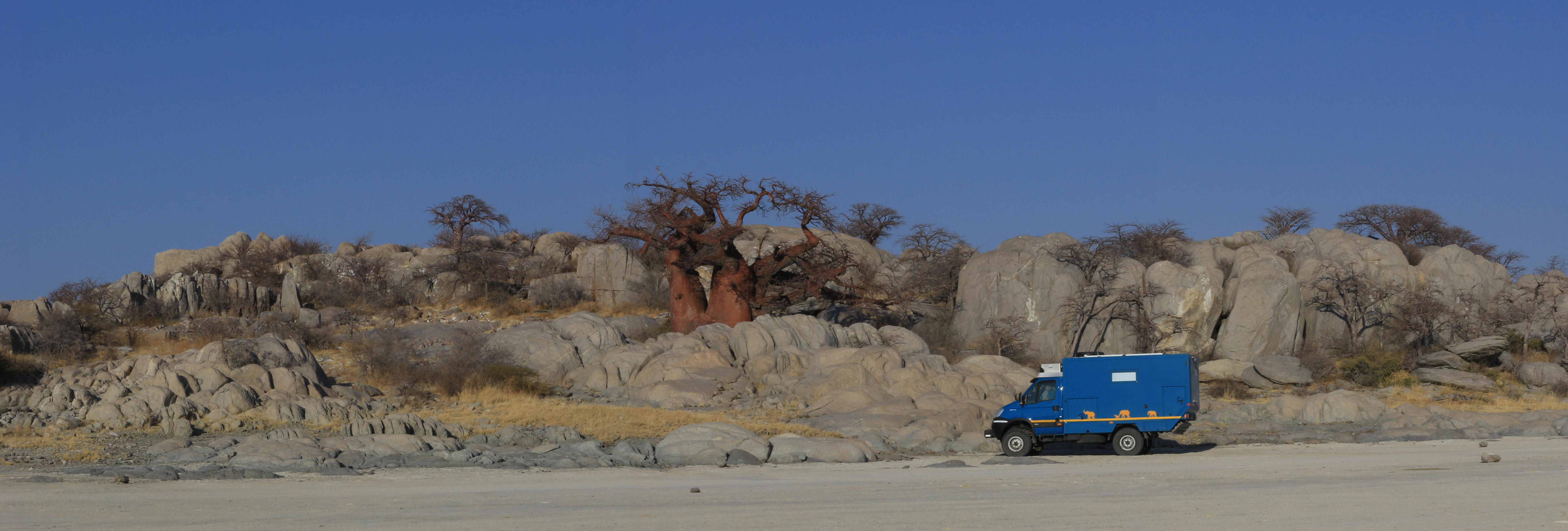
Kubu Island
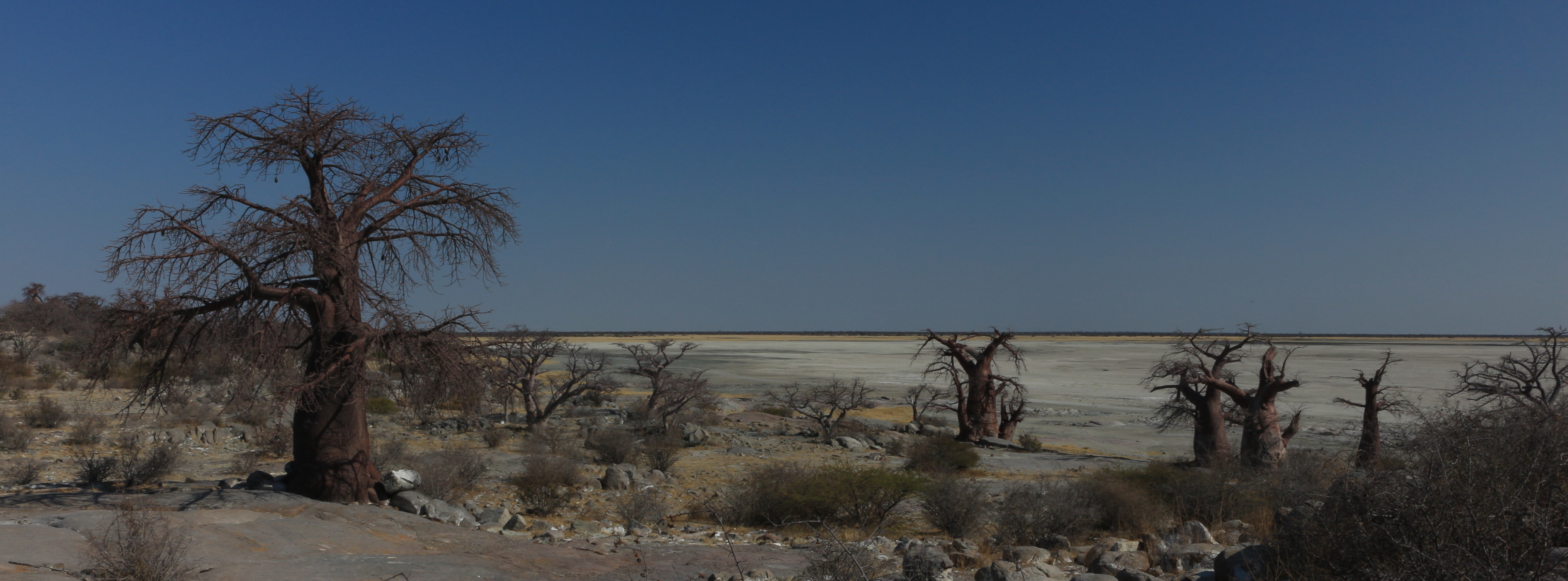 Next we headed back to the main road at Rakops and then east on the long tar road for around 3 hours. The fabled Lekhubu, otherwise known as Kubu, is an ‘island’ in the middle of the massive Sua Pan, just east of the Makgadikgadi.
The ‘island’ is a curious blend of beautifully weather-beaten boulders and the magnificent baobab trees. It’s a special place with particular spiritual significance for the local indigenous people. Our sources reliably inform us that although this is one of Botswana’s most stunningly beautiful, ‘must see’ locations, it can be tricky to get to – particularly with a heavy vehicle. Sitting in a vast salt pan, the tracks to the island become extremely soft and swampy when there has been any rain. There has been no rain for a while now and the surface crust of the pan is quite hard and dry. However somewhere under that crust is a deep, sticky, slimey mud-pan just waiting to trap a vehicle that breaks through the surface crust.
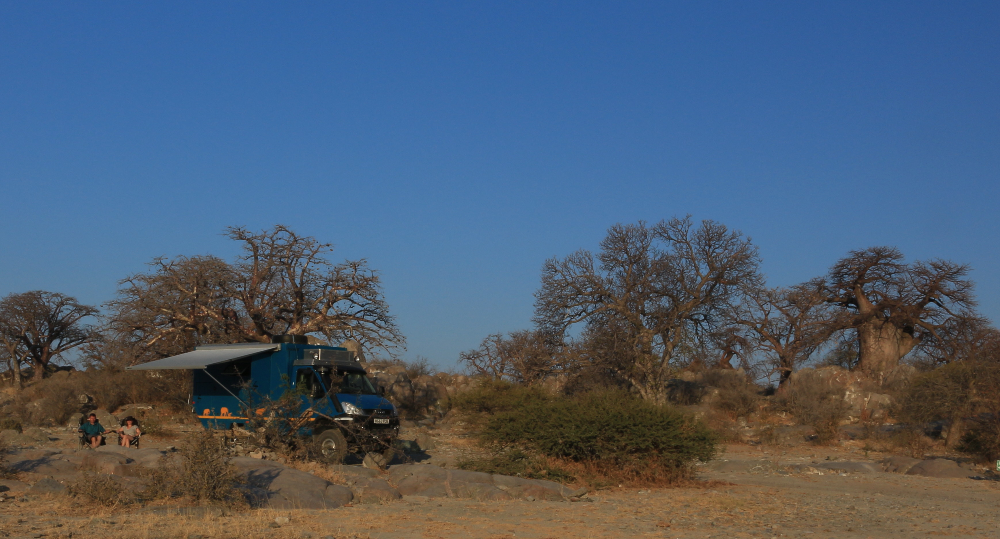
G&Ts ready and chilled at Cuthbert camp on Kubu Island
‘Ordinary’ 4x4s do the journey every day at this time of the year with no problem. However Cuthbert is no ‘ordinary 4×4’. At around 5,900kg, he is around 70% heavier than your average loaded-up over-landing Land Rover. We could not be sure whether the crust on the pan would hold Cuthbert, or whether he would crack through the top-layer and sink into the mud as we headed off the ‘shore’ and onto the pan. Worse still, he could head away from the shore safely, then hit a soft-patch out in the middle! After our small ‘event’ at Sandwich Harbour in Namibia we were particularly nervous about this (see the You-tube video embedded on Africa Blog 2. Namibia – when we followed well established tracks made by other lighter 4x4s, but still sank through the surface into wet sand below) .
We sat nervously as Cuthbert took us across the pan to the safety of the ‘island’ in the middle. Phew! Looking at some of the deep tyre-tracks in the soft-stuff alongside the main track, we realised that it would have been a different story had we strayed from the ‘super-highway’ by even just a few feet in some places. But ‘Hurrah for Cuthbert!’, he delivered us there safely! And two days later, back again to the ‘shore’.
Notwithstanding the slightly nerve-wracking journey to get there, we can confirm the previously found reports that Kubu Island is a stunning location and lovely camp-spot.
Zim-wards
The amazing Kubu Island was the last of our short itinerary in Botswana and we headed east towards Francistown and the Plumtree border with Zimbabwe. It has been a fairly rapid dash across the country, but we have thoroughly enjoyed seeing the few parts of Botswana that we had not been able to include on previous holidays.
Here is a quick overview map of our route in Botswana (note: red line = our route on this trip in Cuthbert; blue line = our previous trips in other vehicles).
Now tune in to the new Zimbabwe page for the next instalment of Cuthbert’s adventures in Africa… 🙂 Or click here for our Return to Botswana in 2015: on our way back south we covered the much overlooked Khama Rhino Park and the chilled-out Tuli Block.