We’re in the Norwegian Arctic. We’ve just crossed the Polar Circle heading north to destination Nordkapp … the furthest north we can drive in the world. In winter. On the plus side: the snow and the low winter light makes it particularly spectacular, no summer crowds, and no midges!! On the down side: it’s chilly, driving is a bit tricky, it’s chilly, many of the tourism facilities are closed, and it’s chilly. So is a winter drive to Nordkapp worth it? And did we mention it’s chilly?
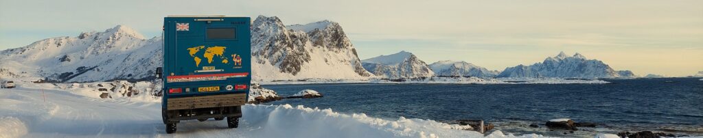
Lofoten Winter
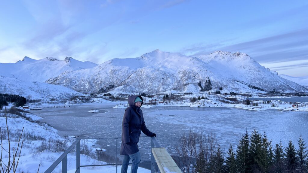
Lofoten is a group of islands within the Arctic Circle. It’s not hard to see why it’s one of Norway’s biggest tourist areas. We arrived by ferry into the south from mainland Norway. Before we even docked into Moskenes, we could see the truly spectacular scenery stretching up the coast. Many of Norway’s iconic images are taken around these islands.
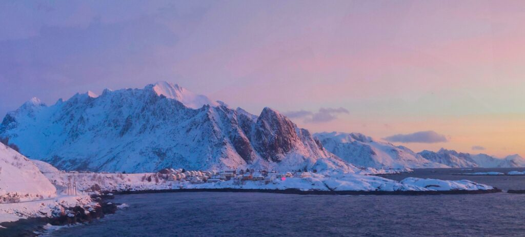
Given the extreme winter climate here, the vast majority of visitors understandably come in summer when it gets packed to the gunnels. But even now in mid-winter, we have been surprised by how many tourists/rental cars we have seen. The downside of course, is the cold (duh!). The hikes are mostly blocked with snow and most tourism businesses are closed. But on the plus side, the scenery backed by the beautiful pink Arctic winter light is special and rightly attracts some hardy photo-tourists.
Given the main attractions here are the views, there’s not much more to say than to show a few pics. We’re not particularly skilled photographers, and we’re certainly not sufficiently dedicated as to be standing around in sub-zero temperatures (with oh-my-god windchill factors) waiting for that ‘perfect light’ moment, but it’s really not difficult to get a great shot around here. Just turn up, get your phone out, click-click-click, retire to truck for central heating and hot coffee. Done.
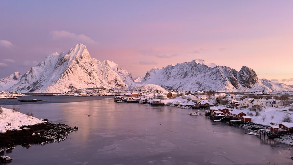
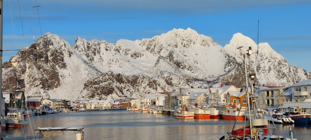
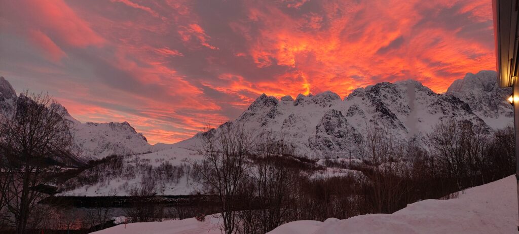
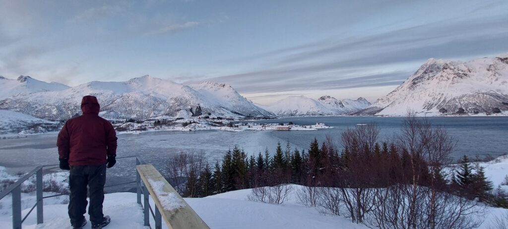
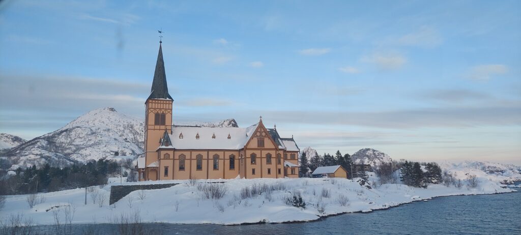
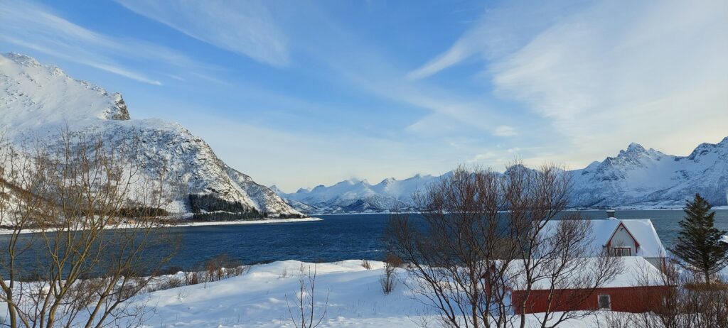
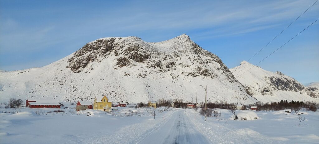
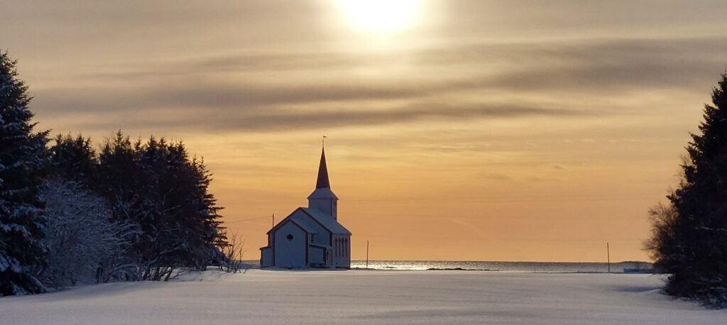
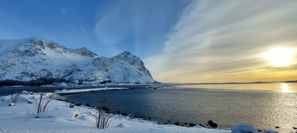
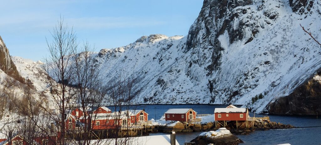
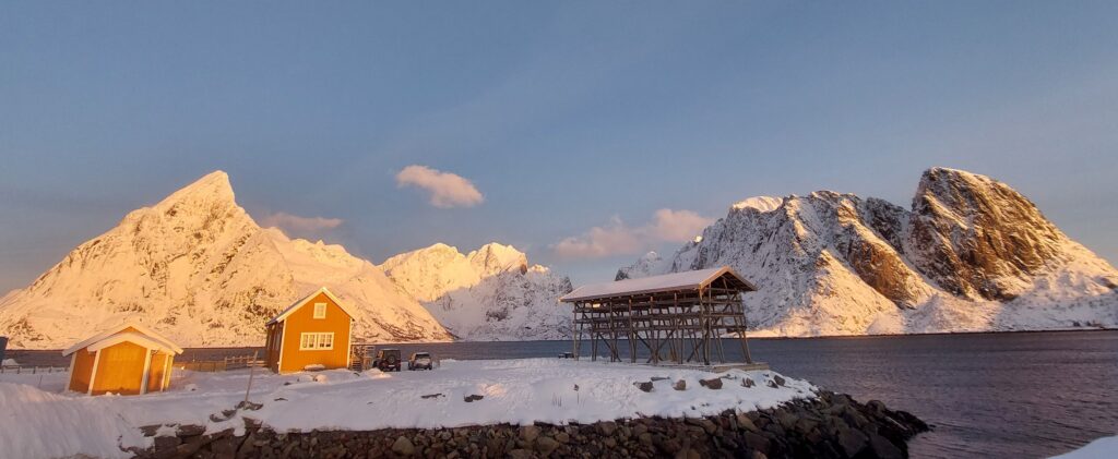
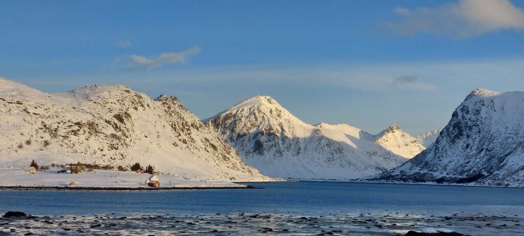
Flick through the Lofoten Gallery – not sure these do justice to the spectacular place
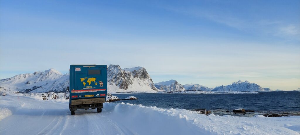
Overlanding Arctic Winter
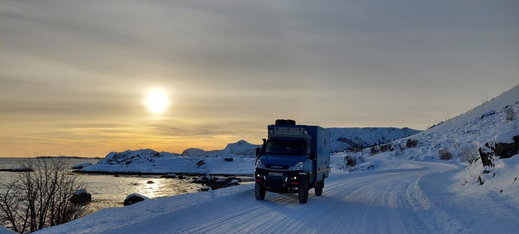
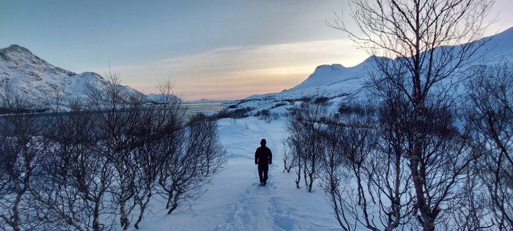
From an overlander’s perspective, a downside of winter travel here is not only that hiking trails are often blocked/closed, but the side-trails for driving into wilderness for wild-camping are also full of snow. In some areas, even the view-point lay-bys at the side of the roads are not snow-cleared, so on the main roads it can be hard to pull-over to take in the views without blocking the road. We found the trick is to try to avoid the main trucking supply-chain routes where possible. The routes which are less ‘trucked’, but still sufficiently ‘major’ to be cleared of the deep snow for basic access to villages, are a nicer drive and not dangerous for pulling over for a wander.
Insurance Stress
Whilst we were on our way up Lofoten we had a bit of a stressy day with insurance…
Back when we arrived in UK from Canada last year, we hadn’t expected to be doing so much long-distance overlanding this year, so we took out a limited mileage policy for Cuthbert. ‘Oh yes…’ the broker assured us… ‘just give us a call and you can extend the mileage cover if you need to later’. But when we came to make that very call, we got a ‘Errr… nope… sorry, mileage is not extendable on this policy’. Bugger!
The remaining mileage on the policy would be plenty for us to loop back south through Scandinavia to England from here, but very tight if we continued to our destination Nordkapp and then back to England. Eeiisssh! We might have to turn around without reaching Nordkapp. Luckily next day, a bit of perseverance with the broker found us a solution to give us the cover we needed to continue the trip northwards. Note to self: next time, get broker’s advice confirmed by email!
Hey ho. Keep calm and continue north.
Skipping Tromsø
Although we got the ferry into Lofoten in the south, exiting northbound there are bridge and tunnel links back to mainland Norway. It’s now a drive of around 900km through the Arctic to destination Nordkapp at the top of Norway. The next place of any significance is the Arctic city of Tromsø, which we decided to skip. Oooooh controversial! Thousands of people visit Tromsø every year. But it’s just a city. We don’t like cities much. We’d just been to Copenhagen and Stockholm and didn’t feel particularly drawn to wandering cutesie tourist shops and cafes. From what we had read, it seemed a great base for fly-in tourists to stay in nice hotels and eat in expensive restaurants, but we saw nothing in the blurb to attract us. We decided to focus on seeing the surrounding fjords and landscapes.


As we pushed on north, a wind-storm was hitting the region and the short-cut ferries across the fjords were suspended due to winds and rough seas. As we zig-zagged around (rather than ferrying across) the fjords, the weather conditions worsened. Cross-winds were strong in exposed places, which posed some challenges driving an aerodynamic brick on icy roads.
Reaching the small town of Alta was a bit of a milestone. We stopped to stock-up on goodies in the supermarket and to visit the Cathedral of Northern Lights. Sadly, we didn’t get to see the cathedral under any actual northern lights. But it’s a cool bit of architecture anyway.


After Alta, the road becomes increasingly desolate and we crossed the 70°18’N latitude line. This is the same latitude as Prudhoe Bay, Alaska, the point at which the most northerly road in North America hits the Arctic Ocean. But here in Europe we still have another 170ish km to go before the road ends.
Norwegian Highway Management
Not much in the way of forests or trees grow at that latitude. We imagine that when the snow melts it reveals a barren tundra in summer. But all we can see in winter is a thick blanket of white, continually blasted by brutal Arctic cross-winds blowing billowing sheets of snow-dust across the road in front of us. Despite the desolation of the landscape and decreasing frequency of habitation, the Norwegians don’t let-up on their impressive constant programme of highway management/maintenance to keep the routes open in winter.
As we pushed on north, our pace of progress slowed. Partly due to necessarily reducing speed in the increasingly extreme conditions, but also due to waiting. Waiting for a clear-weather window and clear roads. As we approached our first road barrier, we learned that avalanches had buried the route ahead. A snow-plough would have to escort us through the worst sections. Fortunately, this kind of storm-damage isn’t unusual in these parts and the locals are reasonably well prepared. They had the main artery road clear in around 6 hours. The small route to Norkapp is cleared by lunchtime the next day. It’s at times like this, with howling winds and bitter cold outside, that we really appreciate being able to stop at the roadside and climb through the connecting hatch into our (heated!) home for supper and a warm comfy bed!


Desolate, not deserted
Moving north through the brutal arctic conditions, the density of population understandably decreases. But it isn’t completely deserted. One major difference we noticed between here in Norway and our time in Canada/USA at the same latitude, is that there are significantly more people living here. Driving across northern Alaska towards the oil plant at Prudoe Bay a couple of years ago, we drove for hours and hours seeing not a single dwelling and very few other vehicles.


Here in Norway, there are occasional settlements, clusters of fishing cottages along the coast, and other vehicles on the road. Just 35km south of Nordkapp, there is the small town of Honningsväg with a busy fishing and cruise harbour, an airport and a population of over 2,500. These people require a round-the-year supply-chain, hence the roads are so well serviced and maintained in winter.
The Last ‘Island’
The hallowed Destination Nordkapp has gained fame as ‘the top of Europe’ and the ‘most northerly point’. But controversially, it’s not actually on the mainland of Norway/Europe. It’s on the island of Magerøya. Magerøya is connected to the mainland by a 7km long underwater tunnel. Nordkapp therefore, is correctly designated the ‘most northerly point in the world that you can drive to’.
Emerging from the Nordkapp tunnel and past Honningsväg, the final stretch of road goes nowhere other than the Nordkapp monument. It therefore doesn’t receive the same high priority for snow-clearing as the ‘main’ roads. We had to wait in Honningsväg overnight before being allowed to proceed. Next day, there was a surprisingly long convoy of around 10-15 cars waiting to be escorted by the snowplough to Nordkapp. This was a two day back-log of visitors who had waited-out the storm to reach their destination Nordkapp. Many of these were clearly rental cars with fly-in tourists, but there were a few other camper-van travellers as crazy as we were, braving the long drive, the wind, low temperatures and icy roads.


So is winter destination Nordkapp worth it? When you reach ‘the top of Europe’ it’s certainly a beautiful spot if you can bear to stand outside in the fierce, bitter wind long enough to appreciate the scenery. But as with most overlanding… the point of going there is the journey and what you see on the way, rather than the destination itself. The destination is just a box to tick as the adventure unfolds. So in that sense, for us, Nordakpp certainly is ‘worth it’ if you’re prepared!
From here, the only way is south. Tune in soon to see how we get on in our country No.53: Finland!