The Dalton Highway is one of those iconic routes that many world overlanders have on their wish-list. It runs through northern Alaska, up to the Arctic Circle, over the remote Brooks Mountains, across vast tundra, ending at the industrial oil-fields on the Arctic Ocean. So why do it? And what do you do when you get there?
Dalton Highway -v- Dempster Highway
Before we get going, a little background for the uninitiated about the rivalry between the Dalton Highway here in Alaska, and the similar Dempster Highway in the Yukon, Canada. Both are loooong, remote, epic overlanding drives across vast wilderness to reach the Arctic Ocean at the top of the Americas. Some overlanders choose the Canadian Dempster as you can take your vehicle all the way to the actual ocean shore at Tuktoyuktuk. In Deadhorse at the top of the Alaskan Dalton Highway, you can’t quite get your vehicle to the ocean shore. However… Deadhorse sits, let’s be precise here… 0.85797 degrees (that’s 95km or 59 miles) further north than Tuktoyuktuk. So Deadhorse is technically the ’winner winner chicken dinner’ in the real ‘Battle for Top of The Americas‘. And you can reach the Arctic Ocean on the Dalton, you just take a shuttle for the last 5 miles.
We have done both highways… well to be honest, we’ve done one and a half. We set out two years ago to do the Dempster and drove over 900 km from the town of Whitehorse all the way up into the Arctic Circle in the Yukon. Unfortunately, we were thwarted in our attempt to reach the Ocean. Covid rules at the Northwest Territories provincial border stopped us in our tracks. So this is now our second attempt to reach the Arctic Ocean, this time on the Dalton Highway.
Pipeline
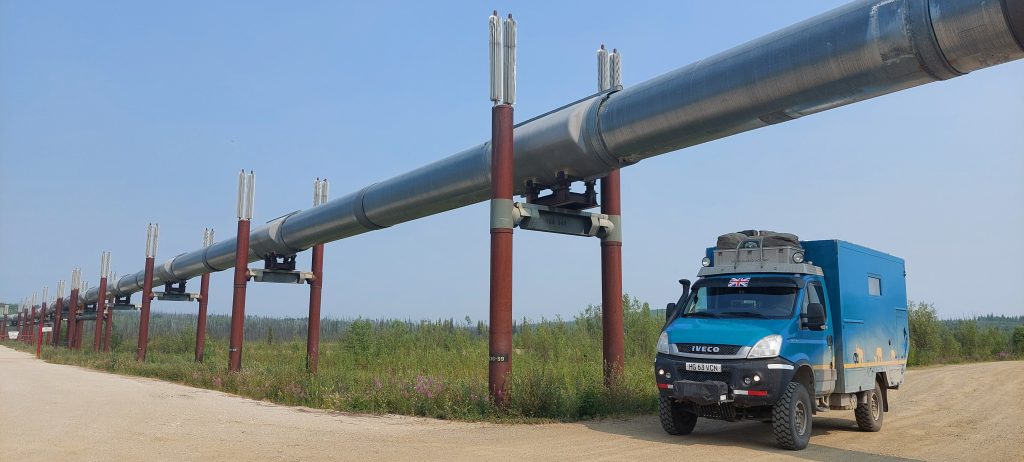
The enquiring mind might reasonably wonder why on earth the Dalton Highway exists. The answer, as it is to so many questions, is black gold… oil. Oil was discovered on the north shore of Alaska in 1967. Getting the oil out of the ground required a road for all the drilling guff. And once they got the stuff out of the ground, they had to schlepp it out to places. And the oil schlepping required a heuuuge pipeline. They started building in 1970. By 1974 they’d built a road. By 1977 they’d built a pipeline around 1,400km/800miles south to the ocean terminal at Valdez. That’s pretty speedy progress (amazing how quickly things can happen when there’s money to be made isn’t it? 😉)
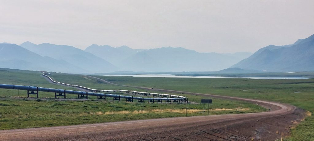
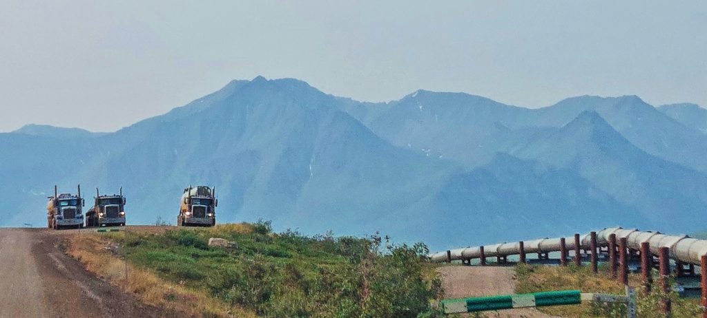
The pipeline runs sometimes above ground, sometimes below ground on its journey from coast to coast. It’s a striking presence, snaking across (some may say ‘scarring’) the landscape for much of the Dalton Highway drive. Whatever your views on these mega-projects and the environment, there’s no denying it’s a phenomenal feat of engineering. So far there have been no catastrophic oil spills, although it is already running some years beyond its originally anticipated 30 year life. They have therefore had to reduce the volume of oil running through the pipe (and therefore the internal pressure on the pipe) to avoid stressing the system to breaking point.
One of the (many) interesting things we learned about the pipeline is how hot the oil is travelling down the pipe. It enters the pipe at approx 60C/140F and by the time it reaches Valdez (800 miles later) it has only cooled to approx 38C/100F. This heat required significant cooling technology to be added to the pipe support structure so as not to affect the frozen permafrost terrain. Who knew, eh???
Let’s start at the very beginning
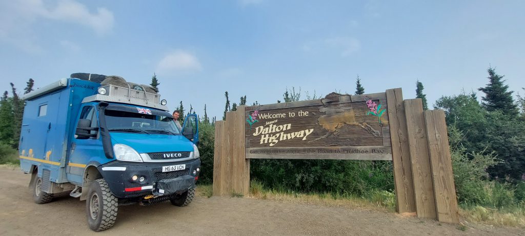
Back to driving the route… the beginning is indeed a very good place to start. But where is the beginning of the Dalton? Many say they started the Dalton Highway at Fairbanks, the most northerly town in Alaska. In fact, as the geeky pedant would point out, the first 125 km out of Fairbanks is actually not the Dalton, but the Elliott Highway. It doesn’t technically become the Dalton Highway until the Livengood junction, well north of Fairbanks. Yeah… right… whatever! We felt like we were on our way up the Dalton as we left Fairbanks. So we’ll be little overlanding rebels and claim the adventure ‘really’ starts at Fairbanks.
Circle Bound
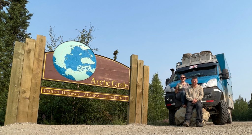
The first ‘section’ of the Dalton Highway leads up to the Arctic Circle. This is a bit of a milestone, the point at which the casual tourist might turn around and head 300km back to Fairbanks proudly claiming: Arctic Circle – tick, done! It’s a cool thing to do.
The spot is, as you might expect, marked by an appropriate sign, but otherwise it has a rather unremarkable feel to it. Yes, it’s remote. But somehow it doesn’t have the same feel of extreme wilderness that you get crossing the Circle on the Canadian Dempster (which is around 500km from the last village of Dawson, and a whopping 900km from the last city of Whitehorse). We think the difference might be trees. Here in Alaska, the Arctic Circle line is still in dense spruce forest; in Yukon the Artic Circle is in vast open tundra where you can watch your dog run away for two weeks. Whatever… here we are (again) at the Arctic Circle for the obligatory sign-post photo.
Milestones
Once you’re in the Arctic, the road continues another 100km to the tiny ‘village’ (such term used in the loosest possible sense of the word) of Coldfoot. Here you’re around 400km from Fairbanks, which is around half-way to Deadhorse. Coldfoot was originally a little community of trappers and hunters but now there’s a small, basic truck-stop. There is also an Arctic Visitor Centre, staffed by a couple of rangers with an impressive knowledge of the region.
All along the route are occasional milestone spots to stop and read a noticeboard with information about the nature, the indigenous history or maybe the history of early European explorers to the region. Each spot is given a name connected with its story. Call us childish (you’d be correct), but the amusingly named ‘Gobblers Knob’ did cause us to snigger 😬.
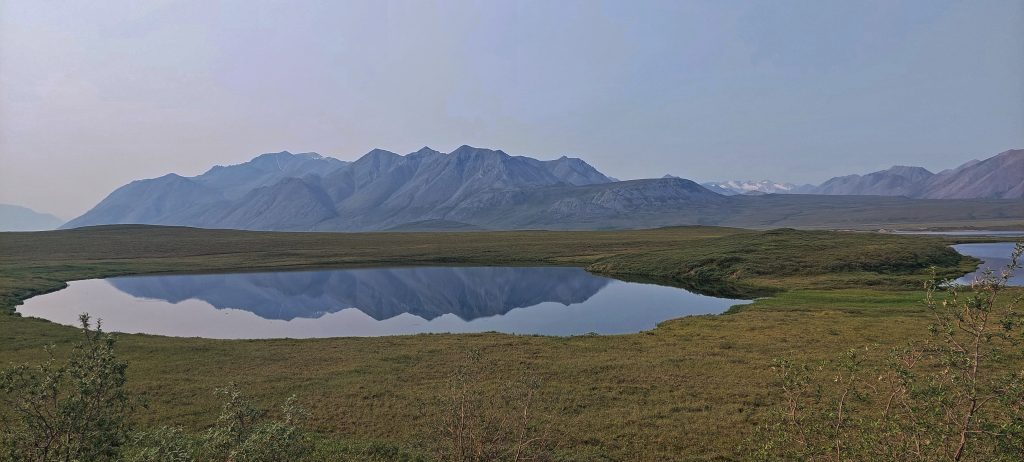
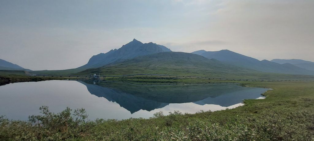
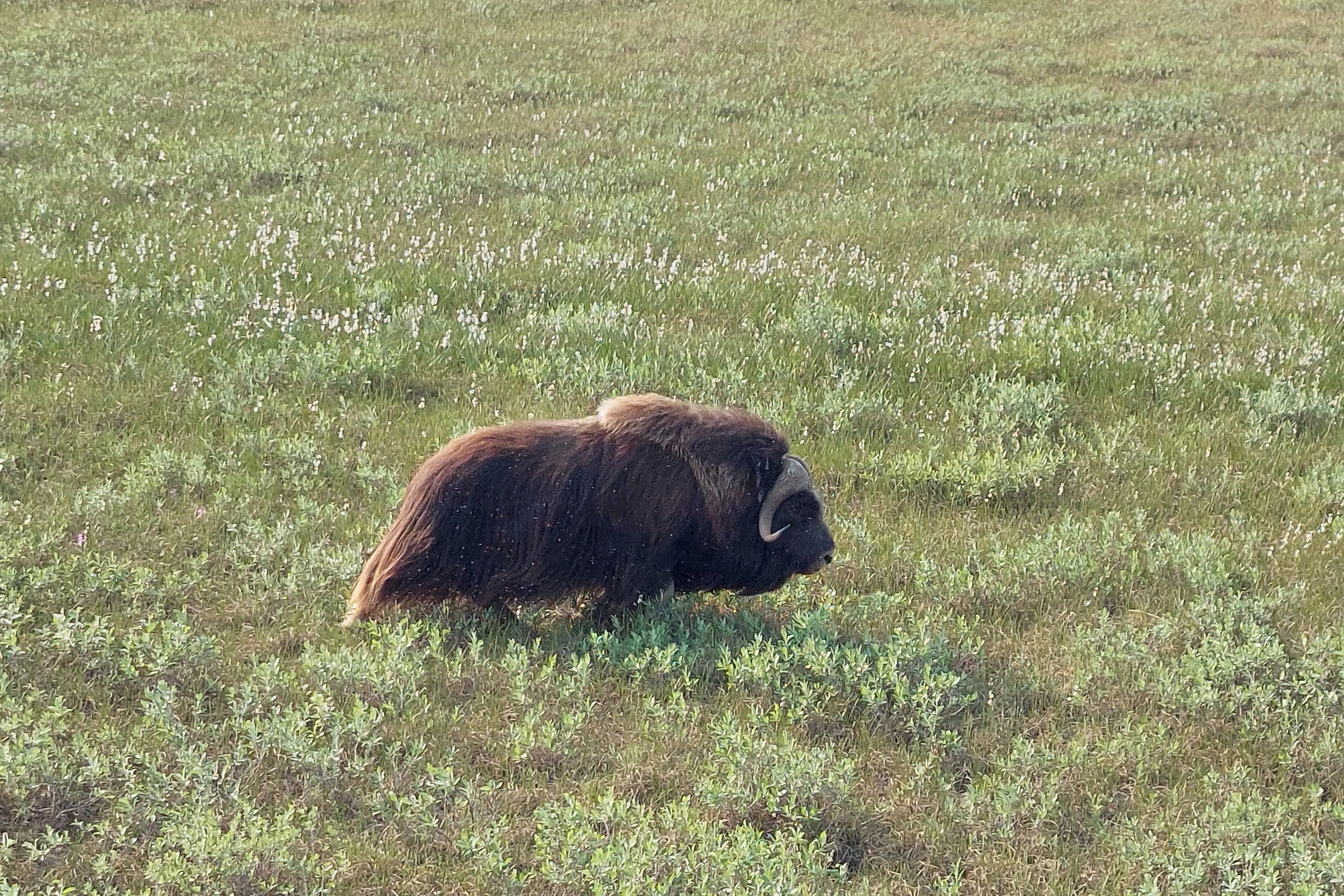
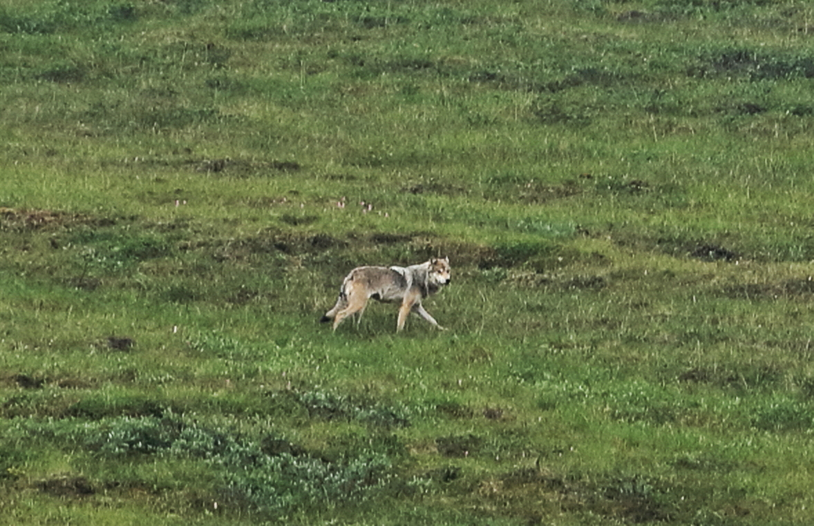
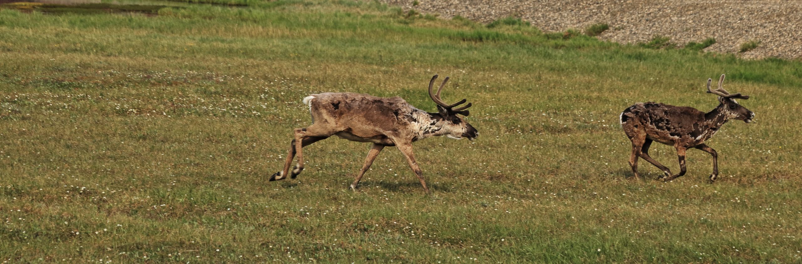
One reason to ‘do the Dalton’ is the scenery along the way. Readers of our recent blog may recall a glacier or two featuring in our Alaska travels so far. But not here the ubiquitous glacier of southern Alaska. No sir! Here on the Dalton Highway, the scenery starts as rollercoaster hills of many fir trees, leading to increasingly sparce spruce trees, then over the desolate Brooks Mountains. From Atigun Pass it’s a descent down the North Slope to the totally treeless tundra and finally the swamp of the Arctic coastal plain. The wildlife on the route is extraordinary… we saw moose, lots of muskox, plus caribou, grizzly bear, wolf, arctic fox and lots of migrating birds/geese/swans.
Smokey
We’d like to say that we saw spectacular scenery all the way up the Dalton, but if we’re honest, we can’t. We certainly saw good evidence of said spectacularity, but unfortunately not the full shebang ☹. Sadly, our enjoyment of the views was marred in some places by smoke. We had heard that drifting smoke might be problem, and it was. It turned out however, that the source of the drifting smoke was actually a lot closer than we thought.
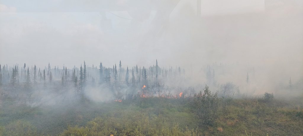
Just north of the Arctic Circle we came across a wildfire burning uncontrolled alongside the road. It wasn’t large by the standards of the multi-acre fires we’d heard of here, but it was throwing out awful smoke across the road. It was also spreading quite rapidly towards what we guessed might be a hazardous proximity to the oil pipeline. An optimistic assessment of the situation might assume that the pipeline is suitably insulated to protect against the random forest fire passing through, but what if it isn’t, eh?
Referring to our Alaska Government ‘What to know on the Dalton’ leaflet, we found a phone number on which they asked for wildfires to be reported. Using our Sat Phone (no mobile phone signal out here!) we called-in the fire’s exact location. The officer took the details, said it was “of concern”, thanked us for the report and dispatched a team to check it out.
That Trucking Road
One of the reasons some overlanders decline to drive the Dalton Highway is because of its reputation as a terrible rough, gravel road on which 50 monster-truckers per hour will blast past, splattering your windscreen in grit to chip and crack it into oblivion. Well, the good news is that the road is nowhere near as bad as its reputation suggests. There are far fewer trucks than we expected and most of them we’re kind enough to slow down as they approached. We would hazard a guesstimate that around 50% of the route is now surfaced tarmac. Nowhere is 4×4 or high-clearance required and it’s an easy drive for any vehicle.
The bad news is that despite all this, one monster-truck did manage to ping us with gravel and get a small crack in Cuthbert’s windscreen ☹. Any loyal Cuthbert followers over the last few years will recall that in 2019, we had a nightmare with our badly cracked windscreen in Mexico and waited almost four months to receive a new one shipped in. This time it’s nowhere near as bad and we’ve had it stop-drilled to (fingers crossed) prevent it from getting worse. Let’s hope it stays like that!
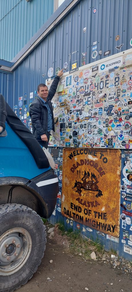
Deadhorse
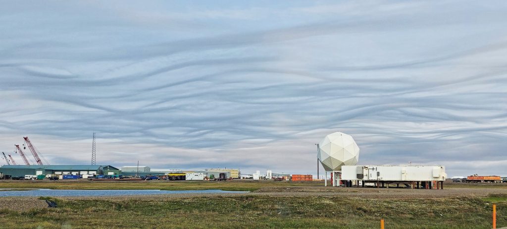
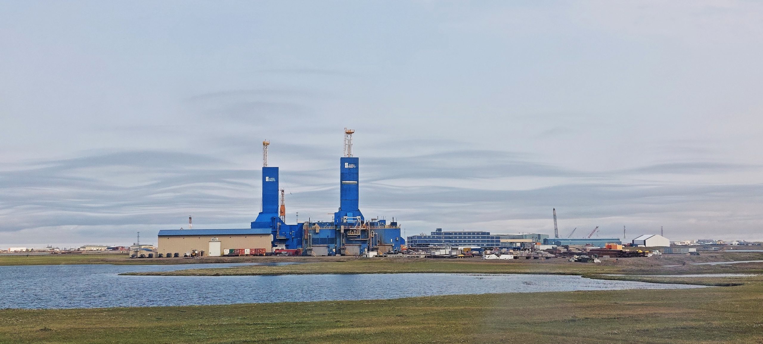
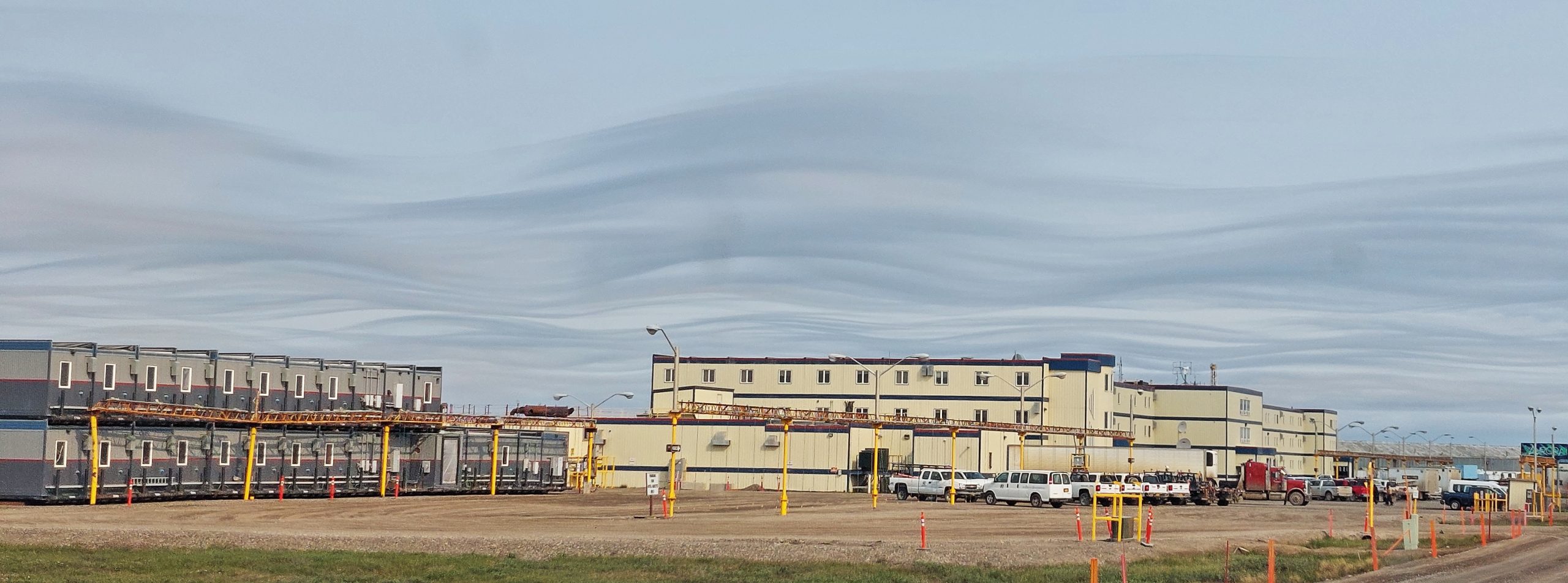
Eventually, just when the tundra seems never-ending, some rocket-like towers puncture the otherwise featureless horizon. With not much imagination, you might think you’re approaching a Bond villain’s secret remote launch site 😂. But no… they’re oil drilling rigs. And that’s all there really is in Deadhorse: the rigs and the immediately essential infrastructure to operate it. All the workers are unaccompanied up there (i.e. no family) living and eating in communal facilities. So although there is one small store with a few bits and bobs, there are no groceries as nobody cooks for themselves. There is a fuel station, but it’s a whopping $8.60 per gallon (yes, UK friends, we know this is pretty normal for you, but this is extraordinarily high for Americans!). Kind of ironic really when it’s at the exact place they’re pulling the stuff out of the ground! 😂
As you might have gathered, we’ll be giving Deadhorse no awards for style and architectural merit. However, it does win our Tucks’ Truck Award for ‘Best Cloud Formation’ we’ve seen in a long time!


Sea Shuttle
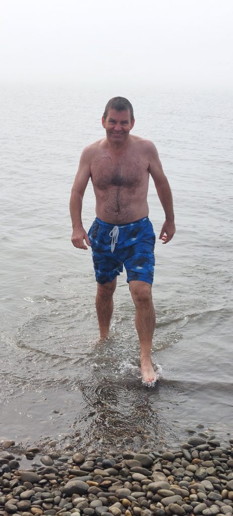
Once you’ve taken all of… oooh… 5 minutes to tour the whole of Deadhorse admiring the hardware, you reach a security booth beyond which the public aren’t allowed to drive. Originally, public access was totally verboten. Then in 1992 The People of America won a legal case against the Prudhoe Bay oilfield concession. Since then, they’ve been required to offer shuttle/tours for the last 5(ish) miles to allow public access to the Arctic Ocean beach. At $69pp for a 10 mile (return) shuttle, the $-per-mile rate isn’t the cheapest in the world. But it is interesting and entertaining. John, the guide takes trouble to explain the oil concession/process, the history, the wildlife (with which the industry seems to co-exist remarkably well) and the way of life up there. Of course, they’re banking on the ‘What’s-another-$69-when-I’ve-come-all-this-way’ kind of attitude from visitors, but we’re glad we did it.
On the tour, your mission (should you choose to accept it) is to swim in the Arctic Ocean. They even provide towels for those nutters brave souls crazy enough to do it. Having swum in the Antarctic Ocean back in 2015 before we set-off north on the PanAm Highway, Marcus decided he’d have to do the Arctic too. Meanwhile, I stood on the beach as a dutiful wife offering helpful words of encouragement from the snug warmth of my ‘Antarctica – Base Camp’ hoodie!


Major Milestone
Once you’ve been to Deadhorse, bought the t-shirt (or in our case, the sticker) and seen the Ocean, what’s next? Well, you just turn around and head all the way back, hoping the scenery looks different in the opposite direction. But before we leave you on the Dalton Highway southbound, perhaps you’d be so kind as to indulge us whilst we do a little jig of joy and celebrate a bit of a thing. Deadhorse arrival is not merely the top of Alaska. The Dalton Highway is the final northerly section of the whole Pan-American Highway, leading (indirectly) all the way to Ushuaia, Tierra del Fuego at the most southerly extent of Argentina.
For us, reaching the top of the Pan-Am Highway is a major milestone in our travels. It’s just 15,300km as the crow flies to Ushuaia at the bottom of the Pan-Am. Due to the odd detour along the way to easterly places such as Brazil, the Guyanas, Florida and Newfoundland, we drove a total of 216,771km, taking six years, six months and 11 days. So we didn’t exactly take the quick route, but still… it feels like a bit of an achievement we can be proud of. Of course, we added a Tucks’ Truck sticker to the collection of others who got there before us.
If you’d like to read our bloggy-thing with the full (very long) story of our six and a half years since Ushuaia click here. In the meantime, we’ll be on the road south…