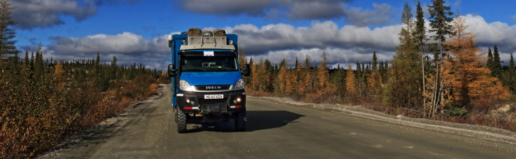
You don’t drive the Trans-Labrador Highway for anything particular to see on the way. You drive it because it’s there. Because you can. Because there is still a teeny sense of adventure to doing it. Not so much to see what’s there, but rather what’s not there. From disembarking the Newfoundland ferry it’s over 1,700km of remote and desolate road all the way across Labrador into Quebec and back to civilisation at the St Lawrence Seaway coast. But that’s not to say there isn’t anything to see at all. There is some fabulous scenery and a few spots worthy of distraction along the way.
Along the way
We started at the eastern end, off the ferry from Newfoundland. But before we get going, let’s just get a minor technicality out of the way: yes, we know the Trans-Labrador Highway transits… surprise, surprise… Labrador. It technically stops at the Quebec border. But hey… cut us a bit of slack here… the route is, in practice, one continuous schlepp. It runs for almost 600km after the provincial border into Quebec before there is any sign of community. So with a ‘devil may care’ attitude to formality, we’re treating the whole route as the Trans-Labrador Highway .
Along the Trans-Labrador Highway there are only three communities that might feasibly come close to the definition of ‘town’. First, after around 600km we came to Happy-Valley-Goose-Bay. After another 300km is Churchill Falls. Another 250km brought us to Labrador City. After that we entered Quebec province (only a sign at the side of the road gave any clue of this), changed time-zones and made the home-run of 580km to the end of the Trans-Labrador Highway at the coast. Between these points is a very great deal of nothing. In his RAF days, Marcus and his C-130 crew colleagues knew the region as ‘The Great Canadian F**k-All’ when they used to fly across here 🤣
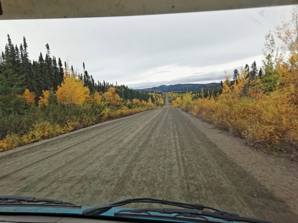
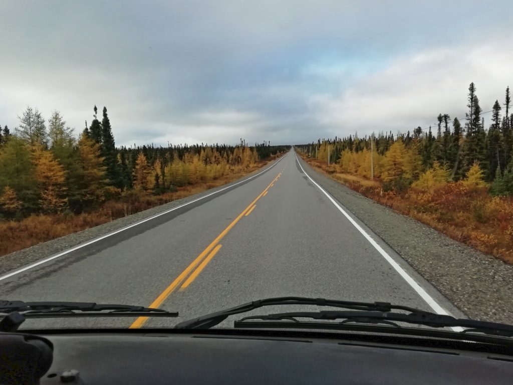
Unlike some other long and very remote routes we have driven in the world, the Trans-Labrador Highway is not a challenging drive. No 4×4 or high-clearance vehicle is required (at this time of year at least; it would be a bit different in the Labrador winter snow!) Much of the route has been surfaced and they’re still working on surfacing even more. These long sections of tarmac inevitably detract from what was once a truly adventurous endeavour from end to end. But there are still some long gravel sections and there is still a bit of a sense of adventure to it.
Despite the smooth-going of the drive, there is no getting away from the sheer remoteness and inhospitable nature of the environment you’re driving through. The provincial government recognises the inherent hazards of the route and offers a free loan of a satellite phone to anyone making the journey if they want one.
The Straits of Belle Isle
We arrived in Labrador across the Strait of Belle Isle from the island of Newfoundland on what is misleadingly said to be the ‘Labrador Ferry’. Not true. The boat from Newfoundland in fact arrives in Blac Sablon, a small port in Quebec province just 5km from the land border into Labrador.
In ‘normal’ times this is no doubt a formality that goes largely unnoticed by many arrivals as they drive off the ferry and head north up the Labrador coast. But we’re in Covid times and we hadn’t realised that the 5 minutes spent in Quebec disembarking the ferry would count as leaving and re-entering NL province. There was a gulp when we saw the checkpoint and a scramble for a few minutes through the files on our phones, looking for the e-permits that we had been issued to enter the province over a month earlier. It would have been a real pain to have been turned around at that point, but we found them… phew!
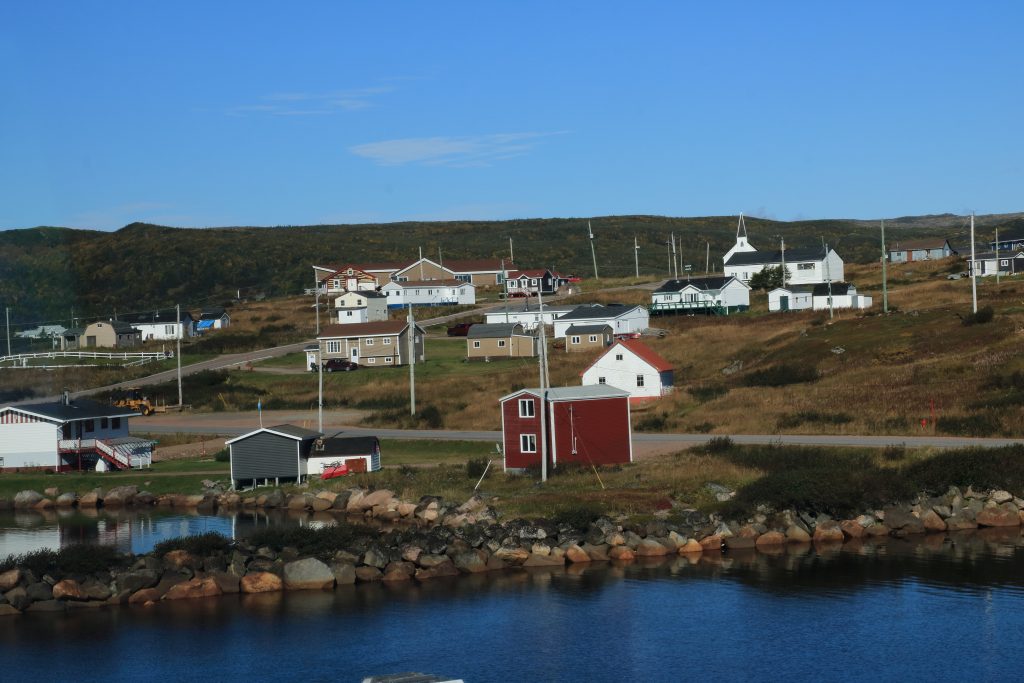
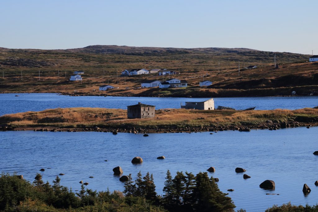
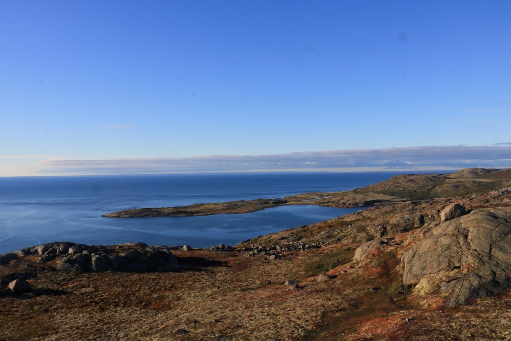
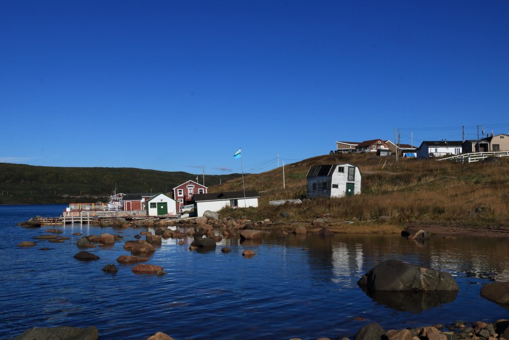
Once we were let loose on the Labrador coast up the Strait of Belle Isle, we found it to be just as beautiful and scenic as the rest of Atlantic Canada (including the lighthouses… of course there are lighthouses). The coast for around 170 km north of the ferry terminal has a bit of a seasonal tourist industry with interesting features such as an old whaling community at Red Bay. But it’s very seasonal, and it’s a very short season. If you want to see what Labrador has to offer the tourist, you get July and August. That’s it. By September, the term ‘Closed for the Season’ goes into overdrive!
At Mary’s Harbour, the vast majority of tourists visit Battle Harbour then turn around and return to the Newfoundland ferry. We turned inland towards Happy-Valley-Goose-Bay.
Happy-Valley-Goose-Bay
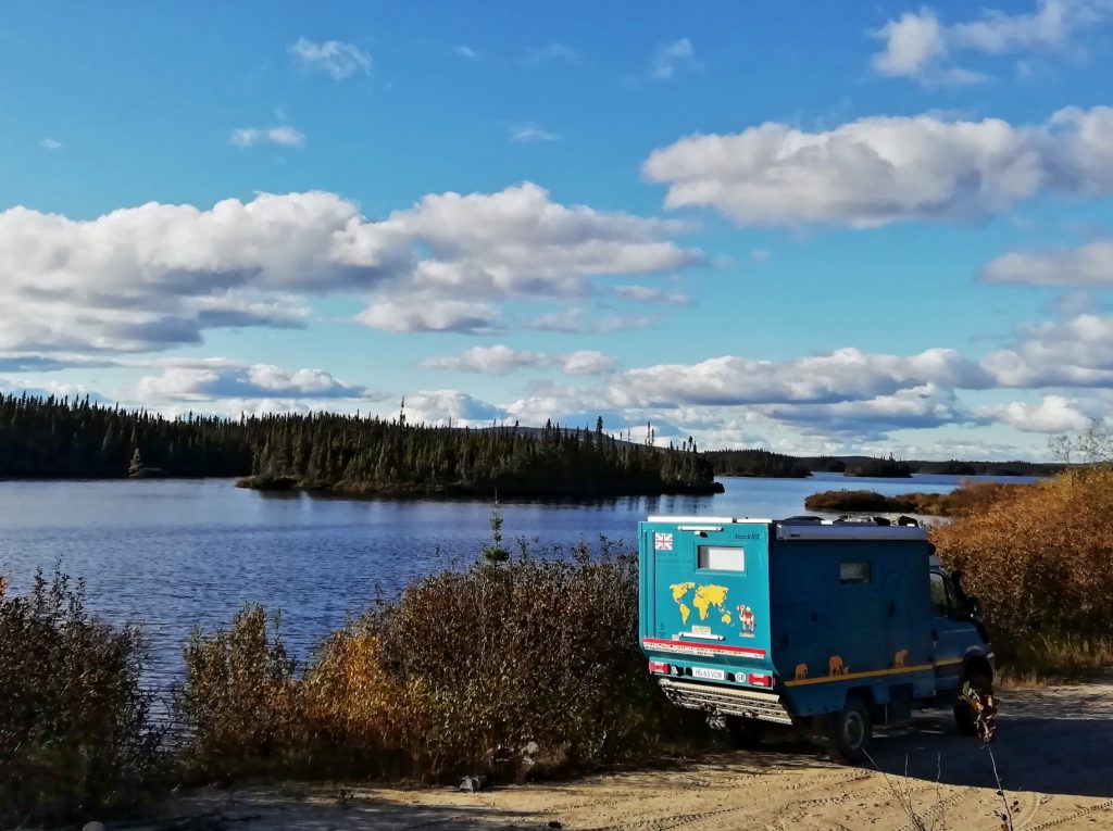
Goose Bay for us has a similar status as Gander in Newfoundland. Although Goose is waaaay more remote than Gander, they are similar in that: a) they both have not a huge amount to attract a tourist (unless maybe you like hunting and fishing… there seems to be quite a lot of that to be had); and b) they both feature in our career histories as overnight refuelling stops for the old RAF C-130 Hercules aircraft in-bound from UK en-route to anywhere in North America. Despite an understandable absence of tourism/overlanding facilities in Goose Bay, it does have the basic admin/supply facilities we needed. We found a beautiful riverside spot to park-up in Cuthbert for a couple of days, slap-bang in the middle of the aforementioned ‘Great Canadian F**ck All’ 😉
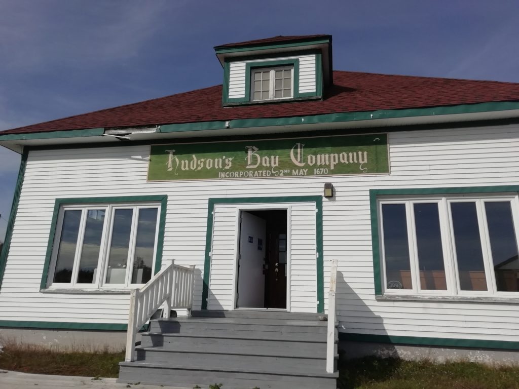
So although it’s not exactly tourist-central, Goose Bay does have a couple of attractions in the area and happily, unlike coastal Labrador, they’re not ‘closed for the season’. At nearby North West River are two great little museums. The Labrador Interpretation Centre is a wonderful, friendly place with a fascinating and high-quality display about the history and culture of the region. The Hudson Bay Co. museum has a large collection of fabulous interactive and fun dioramas reflecting life in the area through the ages. Perhaps not quite of themselves sufficient to justify making the loooong drive up the TLH to get there. But definitely unmissable if you just happen to be driving through the area.
Churchill Falls
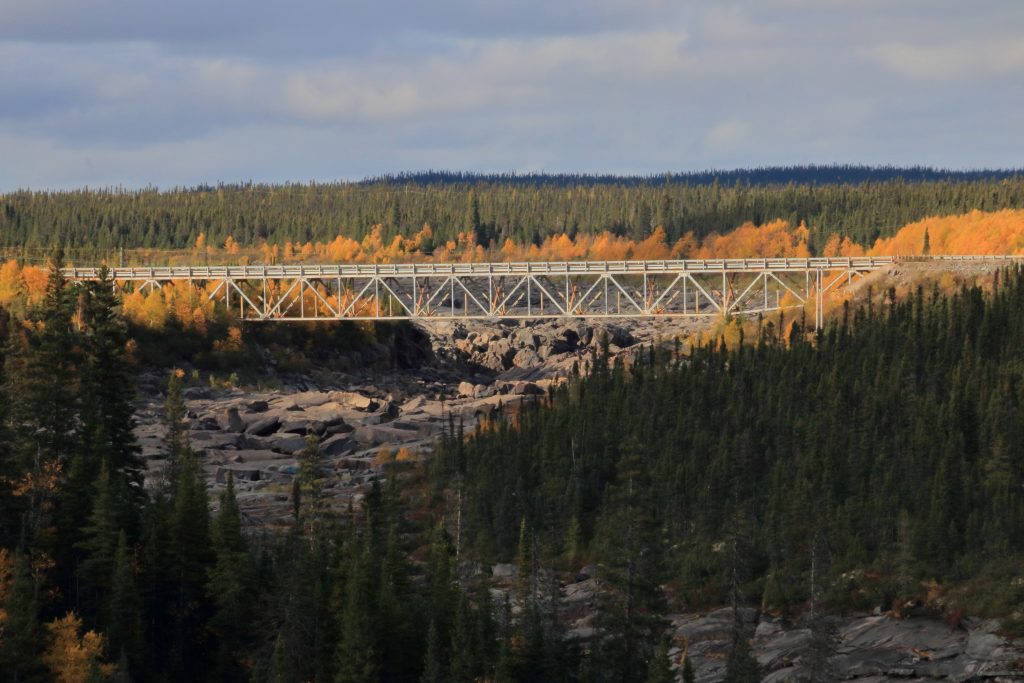
Around 300km down the road from Goose Bay is the community of Churchill Falls. This we found to be a curious place. It’s a company-owned community, existing for energy generating and has only around 650 residents. In addition to the underground hydro-facility, there are a few homes and one single central community building. The school, library, shop, gym and post-office are all under one roof. That’s it. When we visited, Churchill Falls wasn’t exactly a bustling hive of life and activity, but the place doesn’t exist for tourism or visitors like us. It’s a place with a purpose. And the single building makes sense given the extreme winter climate they must endure up there. It’s a privilege for us to be able to visit communities like these and see the how people live in the world.
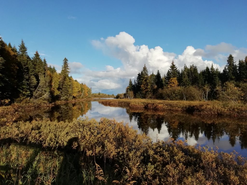
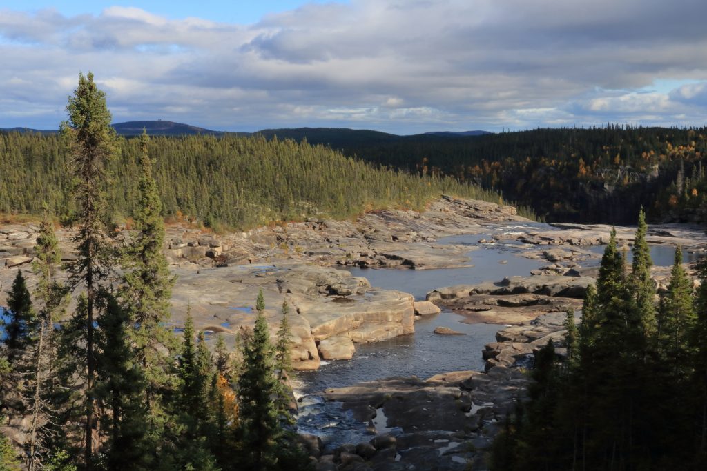
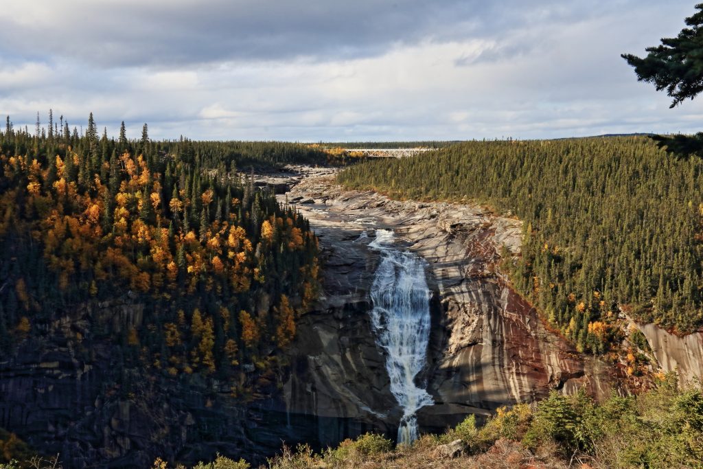
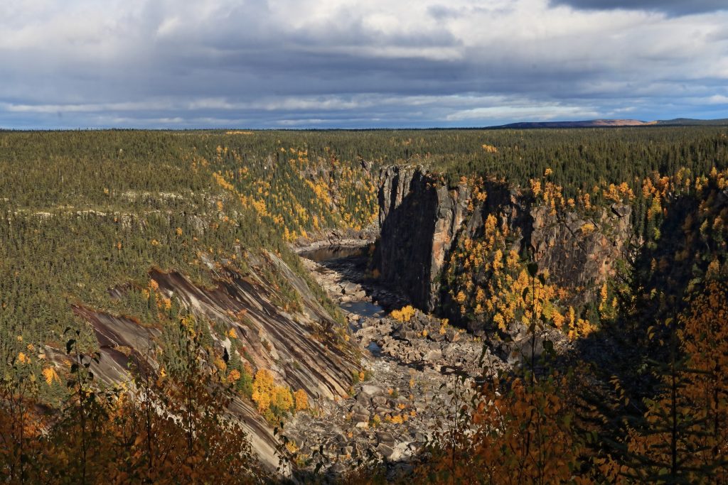
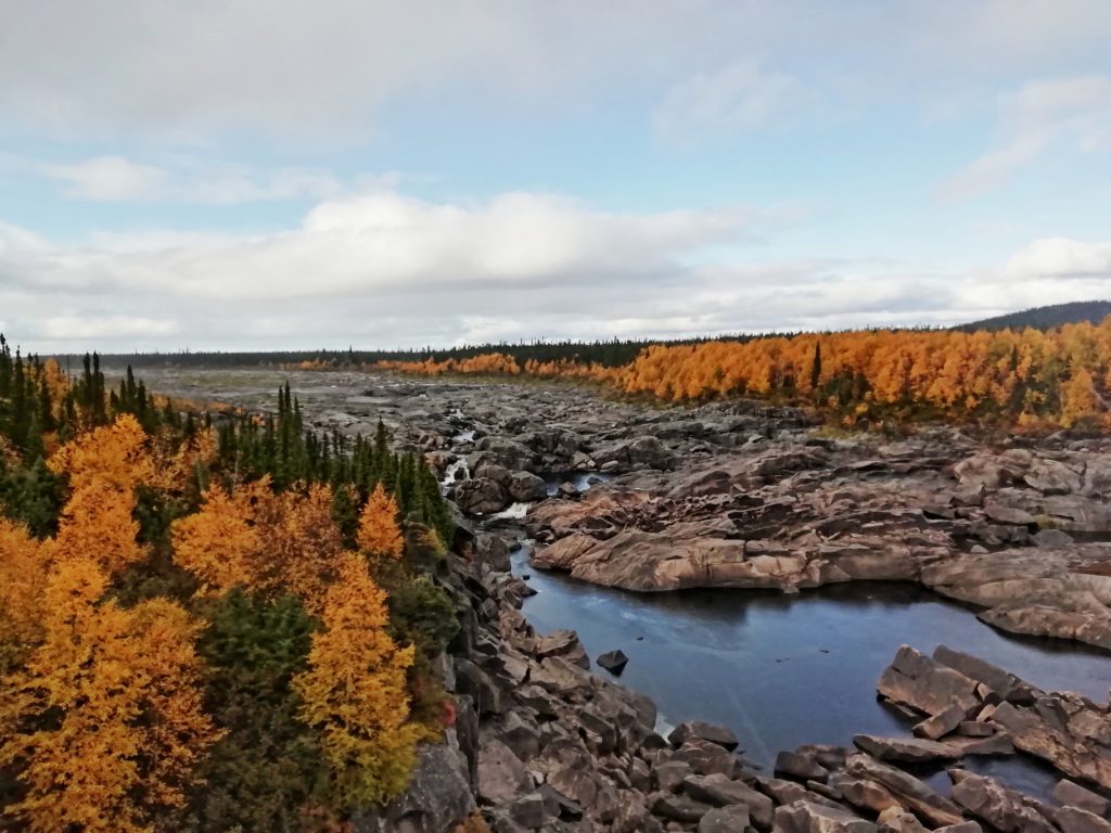
Near Churchill Falls is the namesake waterfall in a very beautiful landscape. This is definitely one of the must-do stops on the Trans-Labrador Highway .
Labrador City
Moving on 250km further down the road is Labrador City. This, compared to Churchill Falls, is a veritable metropolis… it has a population of over 7,000 people and there’s more than one commercial building! Yes… Labrador City has a mall with several shops. A Walmart. A Canadian Tire. A Jungle Jim’s restaurant. And there are other places dotted around on street corners. The choice of venue is bewildering 😉 and it has (by the standards of the region) a ‘happening’ vibe. It was certainly worth a stop for lunch!
Bonjour Quebec
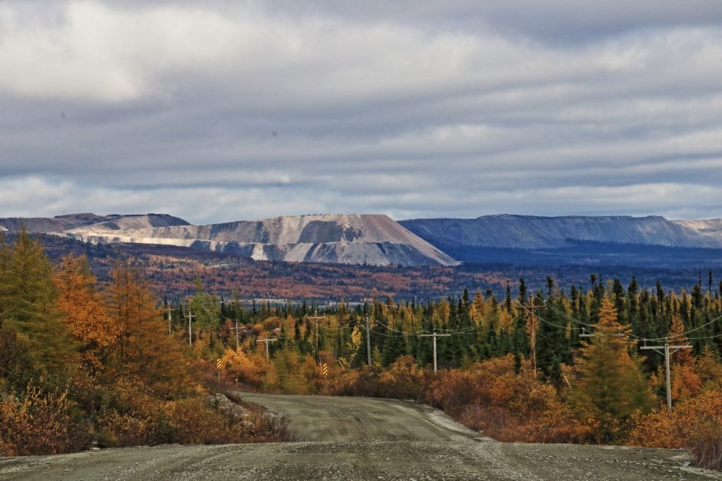
Just a few kilometres down the road from Labrador City is the provincial border and we entered Quebec. It’s now a mere 580km cruise across similarly inhospitable terrain, back to civilisation at the coast of the St Lawrence Seaway. Well, I say ‘cruise’… the Trans-Labrador Highway actually deteriorates a bit on this section and there are much longer stretches of winding, hilly gravel road than tarmac. But it is well-graded and certainly passable by any vehicle (if there’s no snow, at least). It’s mining territory here, so expect interesting, excavation-scarred landscapes.
Other than the mines and the huge monster trucks hogging the highway, there are no communities on this long section of the route. But there are a couple of ‘highlights’ (in the loosest sense of the word 😉) to break the drive.
A brief stop is worth making at the former town of Gagnon, that is, if you don’t blink and miss it. Uh? How is it a former town? Well between 1960 and 1985 there was a mining community here. When the mine closed, the town was completely dismantled and taken away. The streets were hacked-up and nature was allowed to re-claim the land. It’s now a natural-looking hillside, but a roadside informative sign (in French) tells the story. If you look carefully, you can see the old street-side pavement (sidewalk) where children used to walk to school.
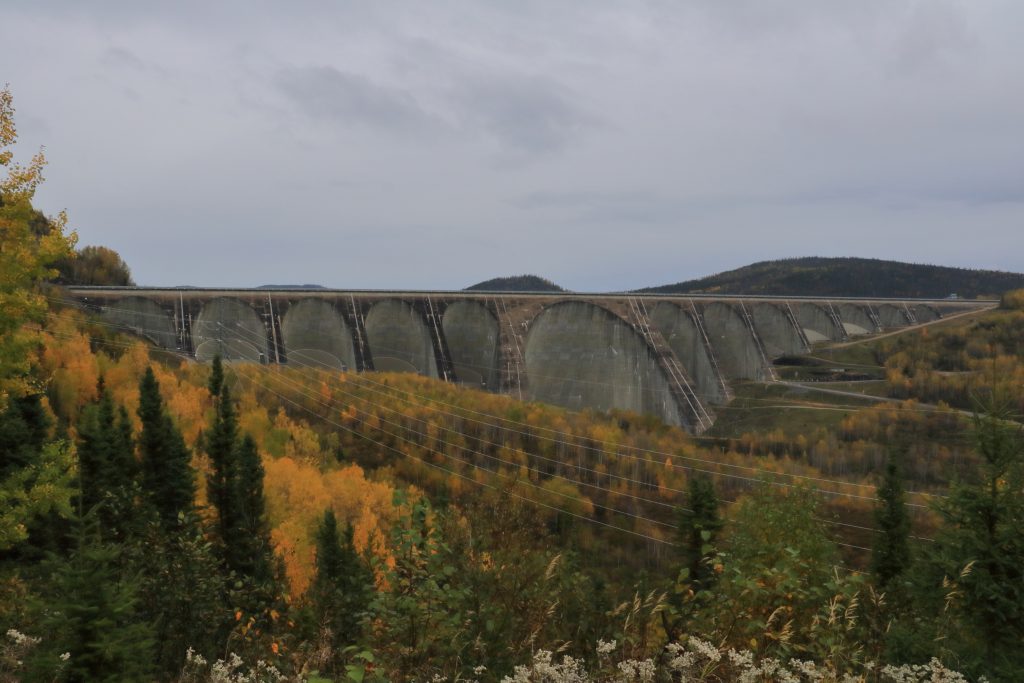
The final stop worth making on the Trans-Labrador Highway is the Daniel Johnson Dam and the Manic-5 hydro-electric power station. It’s not ‘huge’ in the league of some other dams we have seen on our travels (Kariba, Hoover, Itaipú) but these feats of engineering are always impressive. Had we been there ‘in season’ we would have had the opportunity to take a guided tour which is (allegedly) very interesting. But oh… guess what? It’s September… it’s ‘closed for the season’!! We took some pics from the outside and scuttled off the last 220 km to congratulate ourselves on completing the Trans-Labrador Highway.
To drive or not to drive
Often we’re asked whether we would recommend these kind of long, remote road-trips to others. Although we enjoyed the Trans-Labrador Highway as part of a long, slow-travel, full-time overlanding journey in which we get to explore the many corners of ‘real’ Canada, we can’t hand-on-heart recommend it to everyone. The Trans-Labrador Highway is not a roller-coaster ride of interest and great views around every corner. If your time is short, you’ll get far more ‘bang-for-your-buck’ in say, Nova Scotia’s Cape Breton Island and Newfoundland. But if you want to experience the true vastness of Canada and see a part that few tourists take the time to experience, then go for it.
Moose-less
The Trans-Labrador Highway completed our loop through the beautiful provinces of Atlantic Canada. If we have one teeny complaint about our time in the region, it’s that it was moose-less. Canada promised us moose and we got no moose. “Oh, it’s not whether you see any moose in Atlantic Canada, it’s how many moose you’ll see…” we were told.
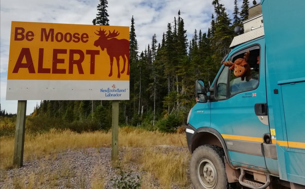
We’ve got to hand it to those clever Canadians… they got us hooked! There we were, earnestly scanning the roadsides every time we saw a ‘Moose Alert’ sign. But we’re now starting to suspect this might just be fake news! Is the moose like a Canadian version of the Loch Ness Monster? A cunning and clever ploy by Canadian people in cahoots with their tourist board to reel all us tourists in? If it is, then it’s a fabulous rouse! But we’ll keep looking on our way through Quebec… y’know… just in case… 😉